You are here: Home > Network List > GS - US Geological Survey Networks Stations List
> Station DEC08 Union Local 159 Surface Site > Earthquake Result Viewer
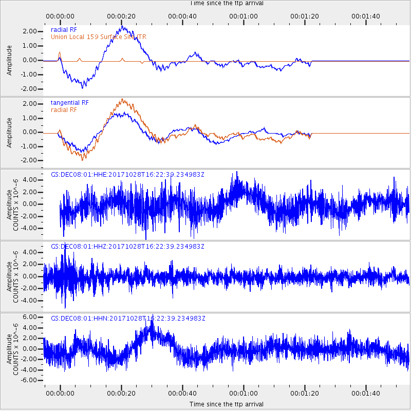
DEC08 Union Local 159 Surface Site - Earthquake Result Viewer
*The percent match for this event was below the threshold and hence no stack was calculated.
| Earthquake location: |
North Of Franz Josef Land |
| Earthquake latitude/longitude: |
86.9/54.5 |
| Earthquake time(UTC): |
2017/10/28 (301) 16:13:54 GMT |
| Earthquake Depth: |
10 km |
| Earthquake Magnitude: |
5.8 Mww |
| Earthquake Catalog/Contributor: |
NEIC PDE/us |
|
| Network: |
GS US Geological Survey Networks |
| Station: |
DEC08 Union Local 159 Surface Site |
| Lat/Lon: |
39.86 N/88.92 W |
| Elevation: |
210 m |
|
| Distance: |
52.9 deg |
| Az: |
324.874 deg |
| Baz: |
2.34 deg |
| Ray Param: |
$rayparam |
*The percent match for this event was below the threshold and hence was not used in the summary stack. |
|
| Radial Match: |
76.54921 % |
| Radial Bump: |
400 |
| Transverse Match: |
76.03435 % |
| Transverse Bump: |
400 |
| SOD ConfigId: |
2364251 |
| Insert Time: |
2017-11-11 16:15:33.435 +0000 |
| GWidth: |
2.5 |
| Max Bumps: |
400 |
| Tol: |
0.001 |
|
Signal To Noise
| Channel | StoN | STA | LTA |
| GS:DEC08:01:HHZ:20171028T16:22:39.234983Z | 2.5251815 | 2.002958E-6 | 7.9319364E-7 |
| GS:DEC08:01:HHN:20171028T16:22:39.234983Z | 1.3481797 | 1.6104059E-6 | 1.194504E-6 |
| GS:DEC08:01:HHE:20171028T16:22:39.234983Z | 1.0993714 | 1.7616156E-6 | 1.6023844E-6 |
| Arrivals |
| Ps | |
| PpPs | |
| PsPs/PpSs | |


