You are here: Home > Network List > US - United States National Seismic Network Stations List
> Station AMTX Amarillo, Texas, USA > Earthquake Result Viewer
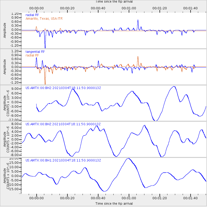
AMTX Amarillo, Texas, USA - Earthquake Result Viewer
*The percent match for this event was below the threshold and hence no stack was calculated.
| Earthquake location: |
Kermadec Islands Region |
| Earthquake latitude/longitude: |
-29.8/-175.7 |
| Earthquake time(UTC): |
2021/03/04 (063) 17:59:00 GMT |
| Earthquake Depth: |
10 km |
| Earthquake Magnitude: |
5.5 mb |
| Earthquake Catalog/Contributor: |
NEIC PDE/us |
|
| Network: |
US United States National Seismic Network |
| Station: |
AMTX Amarillo, Texas, USA |
| Lat/Lon: |
34.53 N/101.41 W |
| Elevation: |
1010 m |
|
| Distance: |
94.9 deg |
| Az: |
52.916 deg |
| Baz: |
237.126 deg |
| Ray Param: |
$rayparam |
*The percent match for this event was below the threshold and hence was not used in the summary stack. |
|
| Radial Match: |
76.979614 % |
| Radial Bump: |
298 |
| Transverse Match: |
79.43119 % |
| Transverse Bump: |
295 |
| SOD ConfigId: |
23341671 |
| Insert Time: |
2021-03-18 19:16:06.832 +0000 |
| GWidth: |
2.5 |
| Max Bumps: |
400 |
| Tol: |
0.001 |
|
Signal To Noise
| Channel | StoN | STA | LTA |
| US:AMTX:00:BHZ:20210304T18:11:50.900013Z | 1.3244219 | 2.3516423E-6 | 1.775599E-6 |
| US:AMTX:00:BH1:20210304T18:11:50.900013Z | 1.6375297 | 3.8130347E-6 | 2.3285286E-6 |
| US:AMTX:00:BH2:20210304T18:11:50.900013Z | 0.2283697 | 9.0694533E-7 | 3.971391E-6 |
| Arrivals |
| Ps | |
| PpPs | |
| PsPs/PpSs | |


