You are here: Home > Network List > US - United States National Seismic Network Stations List
> Station EGMT Eagleton, Montana, USA > Earthquake Result Viewer
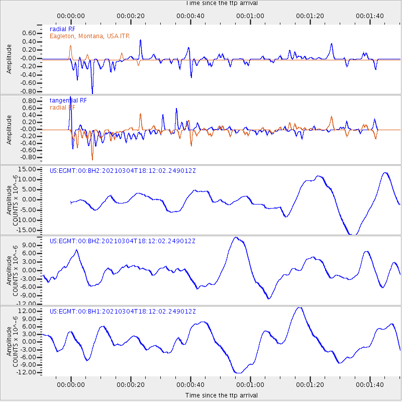
EGMT Eagleton, Montana, USA - Earthquake Result Viewer
*The percent match for this event was below the threshold and hence no stack was calculated.
| Earthquake location: |
Kermadec Islands Region |
| Earthquake latitude/longitude: |
-29.8/-175.7 |
| Earthquake time(UTC): |
2021/03/04 (063) 17:59:00 GMT |
| Earthquake Depth: |
10 km |
| Earthquake Magnitude: |
5.5 mb |
| Earthquake Catalog/Contributor: |
NEIC PDE/us |
|
| Network: |
US United States National Seismic Network |
| Station: |
EGMT Eagleton, Montana, USA |
| Lat/Lon: |
48.02 N/109.75 W |
| Elevation: |
1055 m |
|
| Distance: |
97.4 deg |
| Az: |
38.191 deg |
| Baz: |
233.181 deg |
| Ray Param: |
$rayparam |
*The percent match for this event was below the threshold and hence was not used in the summary stack. |
|
| Radial Match: |
77.693726 % |
| Radial Bump: |
298 |
| Transverse Match: |
74.571304 % |
| Transverse Bump: |
344 |
| SOD ConfigId: |
23341671 |
| Insert Time: |
2021-03-18 19:16:12.788 +0000 |
| GWidth: |
2.5 |
| Max Bumps: |
400 |
| Tol: |
0.001 |
|
Signal To Noise
| Channel | StoN | STA | LTA |
| US:EGMT:00:BHZ:20210304T18:12:02.249012Z | 3.2215457 | 5.0009094E-6 | 1.5523323E-6 |
| US:EGMT:00:BH1:20210304T18:12:02.249012Z | 1.0937847 | 3.1955205E-6 | 2.921526E-6 |
| US:EGMT:00:BH2:20210304T18:12:02.249012Z | 1.728401 | 3.7506757E-6 | 2.1700264E-6 |
| Arrivals |
| Ps | |
| PpPs | |
| PsPs/PpSs | |


