You are here: Home > Network List > US - United States National Seismic Network Stations List
> Station ELK Elko, Nevada, USA > Earthquake Result Viewer
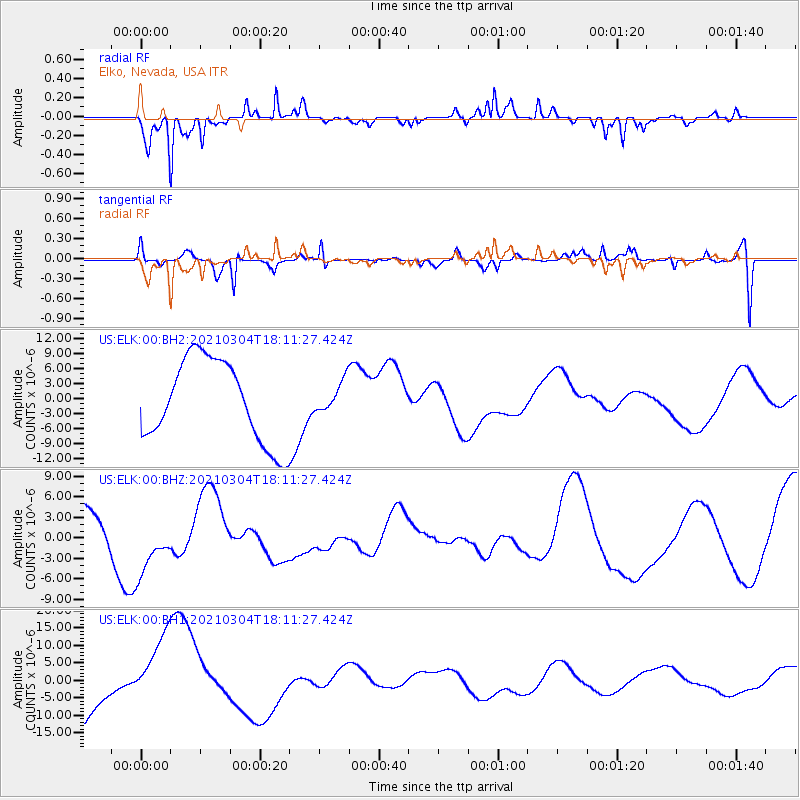
ELK Elko, Nevada, USA - Earthquake Result Viewer
*The percent match for this event was below the threshold and hence no stack was calculated.
| Earthquake location: |
Kermadec Islands Region |
| Earthquake latitude/longitude: |
-29.8/-175.7 |
| Earthquake time(UTC): |
2021/03/04 (063) 17:59:00 GMT |
| Earthquake Depth: |
10 km |
| Earthquake Magnitude: |
5.5 mb |
| Earthquake Catalog/Contributor: |
NEIC PDE/us |
|
| Network: |
US United States National Seismic Network |
| Station: |
ELK Elko, Nevada, USA |
| Lat/Lon: |
40.74 N/115.24 W |
| Elevation: |
2210 m |
|
| Distance: |
89.8 deg |
| Az: |
41.392 deg |
| Baz: |
229.148 deg |
| Ray Param: |
$rayparam |
*The percent match for this event was below the threshold and hence was not used in the summary stack. |
|
| Radial Match: |
58.21359 % |
| Radial Bump: |
293 |
| Transverse Match: |
66.16077 % |
| Transverse Bump: |
400 |
| SOD ConfigId: |
23341671 |
| Insert Time: |
2021-03-18 19:16:13.580 +0000 |
| GWidth: |
2.5 |
| Max Bumps: |
400 |
| Tol: |
0.001 |
|
Signal To Noise
| Channel | StoN | STA | LTA |
| US:ELK:00:BHZ:20210304T18:11:27.424Z | 0.88743895 | 4.2968813E-6 | 4.841889E-6 |
| US:ELK:00:BH1:20210304T18:11:27.424Z | 1.6479814 | 1.167343E-5 | 7.0834712E-6 |
| US:ELK:00:BH2:20210304T18:11:27.424Z | 0.36409563 | 3.001995E-6 | 8.245073E-6 |
| Arrivals |
| Ps | |
| PpPs | |
| PsPs/PpSs | |


