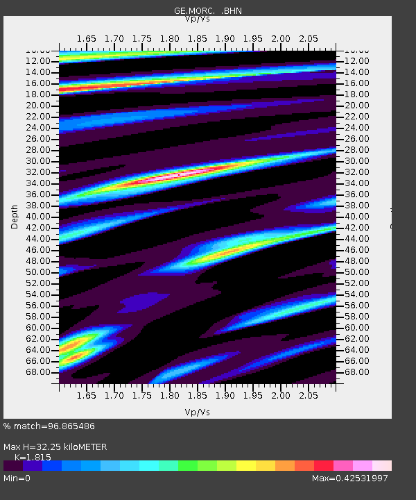
MORC GEOFON Station Moravsky Beroun, Czech Republic - Earthquake Result Viewer

Earthquake location: Komandorskiye Ostrova Region
Earthquake latitude/longitude: 56.1/165.0
Earthquake time(UTC): 1996/07/16 (198) 03:48:28 GMT
Earthquake Depth: 33 km
Earthquake Magnitude: 5.8 MB, 6.4 MS, 6.5 UNKNOWN, 6.3 MW
Earthquake Catalog/Contributor: WHDF/NEIC
Network: GE GEOFON
Station: MORC GEOFON Station Moravsky Beroun, Czech Republic
Lat/Lon: 49.78 N/17.54 E
Elevation: 740 m
Distance: 71.1 deg
Az: 338.367 deg
Baz: 18.589 deg
Ray Param: 0.05450608
Estimated Moho Depth: 32.25 km
Estimated Crust Vp/Vs: 1.82
Assumed Crust Vp: 6.276 km/s
Estimated Crust Vs: 3.458 km/s
Estimated Crust Poisson's Ratio: 0.28
Radial Match: 96.865486 %
Radial Bump: 228
Transverse Match: 72.852325 %
Transverse Bump: 400
SOD ConfigId: 6273
Insert Time: 2010-03-09 05:55:20.782 +0000
GWidth: 2.5
Max Bumps: 400
Tol: 0.001

Signal To Noise

ChannelStoNSTALTA
GE:MORC: :BHN:19960716T03:59:12.289014Z1.46182051.0496631E-77.18052E-8
GE:MORC: :BHE:19960716T03:59:12.289014Z0.939458.427897E-88.971097E-8
GE:MORC: :BHZ:19960716T03:59:12.289014Z2.5208522.0837082E-78.265888E-8
Arrivals
Ps4.3 SECOND
PpPs14 SECOND
PsPs/PpSs18 SECOND