You are here: Home > Network List > GS - US Geological Survey Networks Stations List
> Station OK051 E0350 and S34600 Roads, Ralston, OK > Earthquake Result Viewer
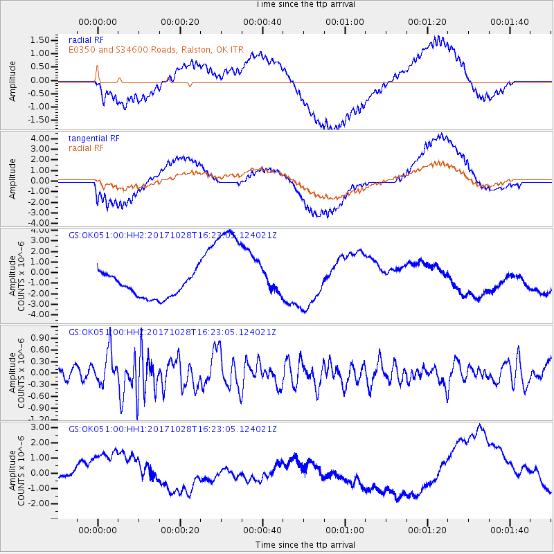
OK051 E0350 and S34600 Roads, Ralston, OK - Earthquake Result Viewer
*The percent match for this event was below the threshold and hence no stack was calculated.
| Earthquake location: |
North Of Franz Josef Land |
| Earthquake latitude/longitude: |
86.9/54.5 |
| Earthquake time(UTC): |
2017/10/28 (301) 16:13:54 GMT |
| Earthquake Depth: |
10 km |
| Earthquake Magnitude: |
5.8 Mww |
| Earthquake Catalog/Contributor: |
NEIC PDE/us |
|
| Network: |
GS US Geological Survey Networks |
| Station: |
OK051 E0350 and S34600 Roads, Ralston, OK |
| Lat/Lon: |
36.51 N/96.84 W |
| Elevation: |
263 m |
|
| Distance: |
56.4 deg |
| Az: |
332.364 deg |
| Baz: |
1.802 deg |
| Ray Param: |
$rayparam |
*The percent match for this event was below the threshold and hence was not used in the summary stack. |
|
| Radial Match: |
68.23712 % |
| Radial Bump: |
400 |
| Transverse Match: |
63.07096 % |
| Transverse Bump: |
400 |
| SOD ConfigId: |
2364251 |
| Insert Time: |
2017-11-11 16:15:54.910 +0000 |
| GWidth: |
2.5 |
| Max Bumps: |
400 |
| Tol: |
0.001 |
|
Signal To Noise
| Channel | StoN | STA | LTA |
| GS:OK051:00:HHZ:20171028T16:23:05.124021Z | 2.7891402 | 4.3473077E-7 | 1.5586552E-7 |
| GS:OK051:00:HH1:20171028T16:23:05.124021Z | 5.0351934 | 1.5704334E-6 | 3.1189137E-7 |
| GS:OK051:00:HH2:20171028T16:23:05.124021Z | 4.6640973 | 4.890008E-6 | 1.0484362E-6 |
| Arrivals |
| Ps | |
| PpPs | |
| PsPs/PpSs | |


