You are here: Home > Network List > TA - USArray Transportable Network (new EarthScope stations) Stations List
> Station R31K City Hall, Gustavus, AK, USA > Earthquake Result Viewer
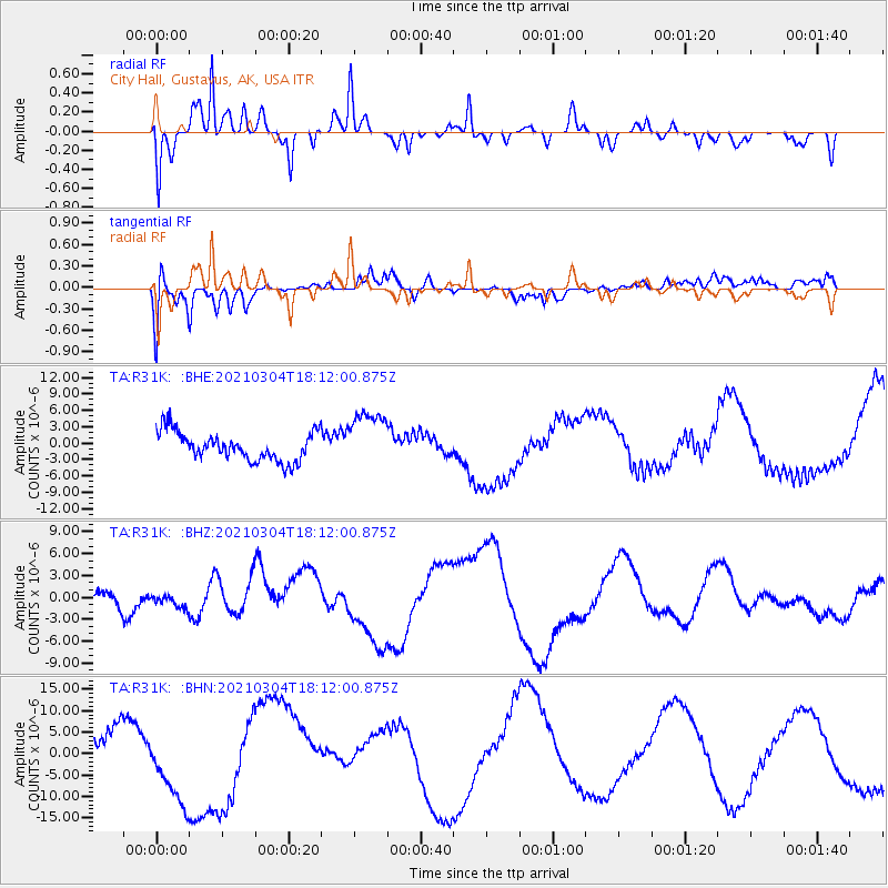
R31K City Hall, Gustavus, AK, USA - Earthquake Result Viewer
*The percent match for this event was below the threshold and hence no stack was calculated.
| Earthquake location: |
Kermadec Islands, New Zealand |
| Earthquake latitude/longitude: |
-30.0/-177.4 |
| Earthquake time(UTC): |
2021/03/04 (063) 17:59:11 GMT |
| Earthquake Depth: |
10 km |
| Earthquake Magnitude: |
5.6 mb |
| Earthquake Catalog/Contributor: |
NEIC PDE/us |
|
| Network: |
TA USArray Transportable Network (new EarthScope stations) |
| Station: |
R31K City Hall, Gustavus, AK, USA |
| Lat/Lon: |
58.41 N/135.74 W |
| Elevation: |
15 m |
|
| Distance: |
94.7 deg |
| Az: |
20.542 deg |
| Baz: |
215.317 deg |
| Ray Param: |
$rayparam |
*The percent match for this event was below the threshold and hence was not used in the summary stack. |
|
| Radial Match: |
70.497505 % |
| Radial Bump: |
221 |
| Transverse Match: |
37.138832 % |
| Transverse Bump: |
400 |
| SOD ConfigId: |
23341671 |
| Insert Time: |
2021-03-18 19:30:35.782 +0000 |
| GWidth: |
2.5 |
| Max Bumps: |
400 |
| Tol: |
0.001 |
|
Signal To Noise
| Channel | StoN | STA | LTA |
| TA:R31K: :BHZ:20210304T18:12:00.875Z | 0.3944424 | 8.2497087E-7 | 2.0914863E-6 |
| TA:R31K: :BHN:20210304T18:12:00.875Z | 3.1642096 | 9.863554E-6 | 3.1172249E-6 |
| TA:R31K: :BHE:20210304T18:12:00.875Z | 2.0587885 | 5.3803064E-6 | 2.6133362E-6 |
| Arrivals |
| Ps | |
| PpPs | |
| PsPs/PpSs | |


