You are here: Home > Network List > US - United States National Seismic Network Stations List
> Station HAWA Hanford, Washington, USA > Earthquake Result Viewer
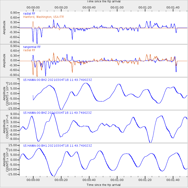
HAWA Hanford, Washington, USA - Earthquake Result Viewer
*The percent match for this event was below the threshold and hence no stack was calculated.
| Earthquake location: |
Kermadec Islands, New Zealand |
| Earthquake latitude/longitude: |
-30.0/-177.4 |
| Earthquake time(UTC): |
2021/03/04 (063) 17:59:11 GMT |
| Earthquake Depth: |
10 km |
| Earthquake Magnitude: |
5.6 mb |
| Earthquake Catalog/Contributor: |
NEIC PDE/us |
|
| Network: |
US United States National Seismic Network |
| Station: |
HAWA Hanford, Washington, USA |
| Lat/Lon: |
46.39 N/119.53 W |
| Elevation: |
364 m |
|
| Distance: |
92.3 deg |
| Az: |
35.904 deg |
| Baz: |
227.284 deg |
| Ray Param: |
$rayparam |
*The percent match for this event was below the threshold and hence was not used in the summary stack. |
|
| Radial Match: |
70.180405 % |
| Radial Bump: |
261 |
| Transverse Match: |
80.179565 % |
| Transverse Bump: |
337 |
| SOD ConfigId: |
23341671 |
| Insert Time: |
2021-03-18 19:32:32.502 +0000 |
| GWidth: |
2.5 |
| Max Bumps: |
400 |
| Tol: |
0.001 |
|
Signal To Noise
| Channel | StoN | STA | LTA |
| US:HAWA:00:BHZ:20210304T18:11:49.749023Z | 2.1003528 | 7.3067877E-6 | 3.4788384E-6 |
| US:HAWA:00:BH1:20210304T18:11:49.749023Z | 2.8622065 | 1.0975082E-5 | 3.834483E-6 |
| US:HAWA:00:BH2:20210304T18:11:49.749023Z | 0.4870601 | 3.7134912E-6 | 7.6242973E-6 |
| Arrivals |
| Ps | |
| PpPs | |
| PsPs/PpSs | |


