You are here: Home > Network List > US - United States National Seismic Network Stations List
> Station CBKS Cedar Bluff, Kansas, USA > Earthquake Result Viewer
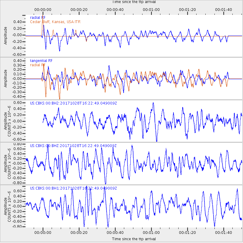
CBKS Cedar Bluff, Kansas, USA - Earthquake Result Viewer
*The percent match for this event was below the threshold and hence no stack was calculated.
| Earthquake location: |
North Of Franz Josef Land |
| Earthquake latitude/longitude: |
86.9/54.5 |
| Earthquake time(UTC): |
2017/10/28 (301) 16:13:54 GMT |
| Earthquake Depth: |
10 km |
| Earthquake Magnitude: |
5.8 Mww |
| Earthquake Catalog/Contributor: |
NEIC PDE/us |
|
| Network: |
US United States National Seismic Network |
| Station: |
CBKS Cedar Bluff, Kansas, USA |
| Lat/Lon: |
38.81 N/99.74 W |
| Elevation: |
677 m |
|
| Distance: |
54.2 deg |
| Az: |
335.247 deg |
| Baz: |
1.677 deg |
| Ray Param: |
$rayparam |
*The percent match for this event was below the threshold and hence was not used in the summary stack. |
|
| Radial Match: |
59.093895 % |
| Radial Bump: |
400 |
| Transverse Match: |
60.131542 % |
| Transverse Bump: |
400 |
| SOD ConfigId: |
2364251 |
| Insert Time: |
2017-11-11 16:18:43.253 +0000 |
| GWidth: |
2.5 |
| Max Bumps: |
400 |
| Tol: |
0.001 |
|
Signal To Noise
| Channel | StoN | STA | LTA |
| US:CBKS:00:BHZ:20171028T16:22:49.049009Z | 2.1796458 | 3.075781E-7 | 1.411138E-7 |
| US:CBKS:00:BH1:20171028T16:22:49.049009Z | 1.9474128 | 2.7441428E-7 | 1.4091222E-7 |
| US:CBKS:00:BH2:20171028T16:22:49.049009Z | 1.0042727 | 1.5788895E-7 | 1.572172E-7 |
| Arrivals |
| Ps | |
| PpPs | |
| PsPs/PpSs | |


