You are here: Home > Network List > US - United States National Seismic Network Stations List
> Station DGMT Dagmar, Montana, USA > Earthquake Result Viewer
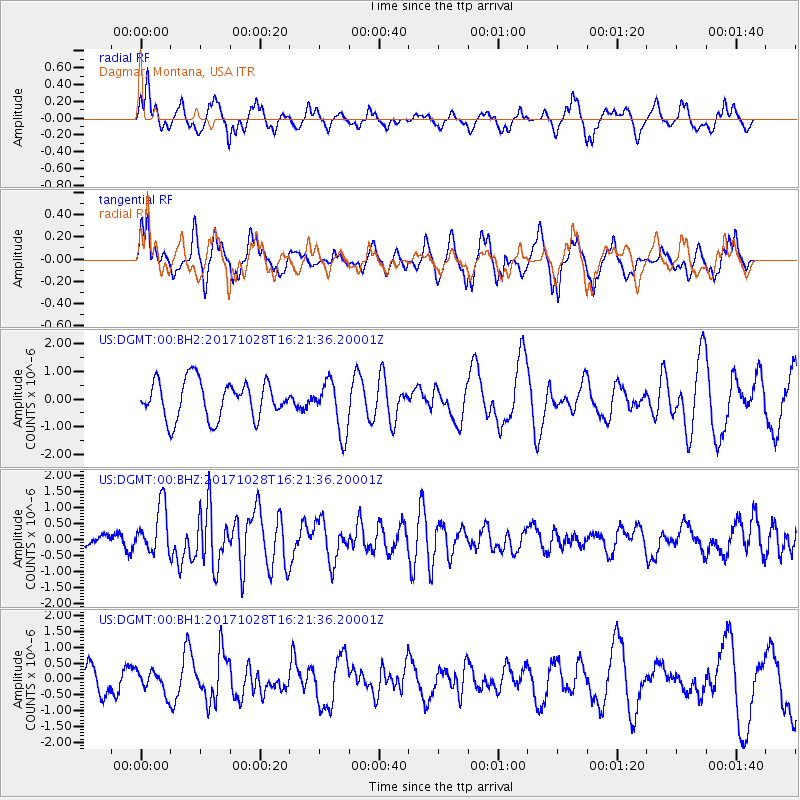
DGMT Dagmar, Montana, USA - Earthquake Result Viewer
*The percent match for this event was below the threshold and hence no stack was calculated.
| Earthquake location: |
North Of Franz Josef Land |
| Earthquake latitude/longitude: |
86.9/54.5 |
| Earthquake time(UTC): |
2017/10/28 (301) 16:13:54 GMT |
| Earthquake Depth: |
10 km |
| Earthquake Magnitude: |
5.8 Mww |
| Earthquake Catalog/Contributor: |
NEIC PDE/us |
|
| Network: |
US United States National Seismic Network |
| Station: |
DGMT Dagmar, Montana, USA |
| Lat/Lon: |
48.47 N/104.20 W |
| Elevation: |
0.0 m |
|
| Distance: |
44.6 deg |
| Az: |
339.871 deg |
| Baz: |
1.618 deg |
| Ray Param: |
$rayparam |
*The percent match for this event was below the threshold and hence was not used in the summary stack. |
|
| Radial Match: |
54.996655 % |
| Radial Bump: |
330 |
| Transverse Match: |
59.250862 % |
| Transverse Bump: |
326 |
| SOD ConfigId: |
2364251 |
| Insert Time: |
2017-11-11 16:18:47.240 +0000 |
| GWidth: |
2.5 |
| Max Bumps: |
400 |
| Tol: |
0.001 |
|
Signal To Noise
| Channel | StoN | STA | LTA |
| US:DGMT:00:BHZ:20171028T16:21:36.20001Z | 2.8999538 | 7.516042E-7 | 2.5917797E-7 |
| US:DGMT:00:BH1:20171028T16:21:36.20001Z | 0.40025783 | 3.4699846E-7 | 8.6693734E-7 |
| US:DGMT:00:BH2:20171028T16:21:36.20001Z | 1.3975267 | 9.508522E-7 | 6.8038213E-7 |
| Arrivals |
| Ps | |
| PpPs | |
| PsPs/PpSs | |


