You are here: Home > Network List > US - United States National Seismic Network Stations List
> Station LAO LASA Array, Montana, USA > Earthquake Result Viewer
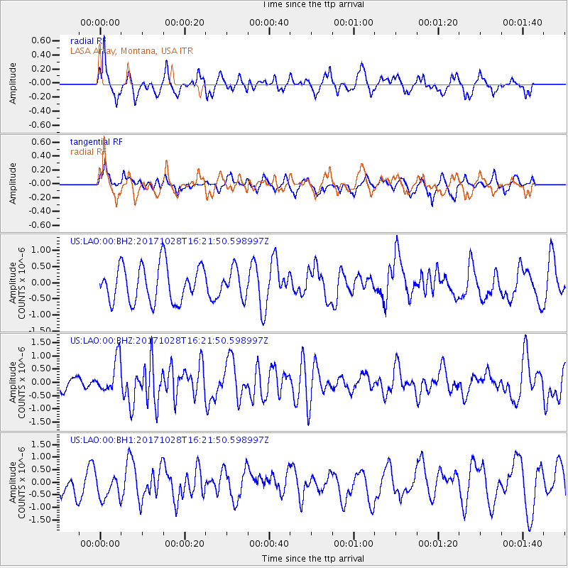
LAO LASA Array, Montana, USA - Earthquake Result Viewer
*The percent match for this event was below the threshold and hence no stack was calculated.
| Earthquake location: |
North Of Franz Josef Land |
| Earthquake latitude/longitude: |
86.9/54.5 |
| Earthquake time(UTC): |
2017/10/28 (301) 16:13:54 GMT |
| Earthquake Depth: |
10 km |
| Earthquake Magnitude: |
5.8 Mww |
| Earthquake Catalog/Contributor: |
NEIC PDE/us |
|
| Network: |
US United States National Seismic Network |
| Station: |
LAO LASA Array, Montana, USA |
| Lat/Lon: |
46.69 N/106.22 W |
| Elevation: |
902 m |
|
| Distance: |
46.5 deg |
| Az: |
341.727 deg |
| Baz: |
1.425 deg |
| Ray Param: |
$rayparam |
*The percent match for this event was below the threshold and hence was not used in the summary stack. |
|
| Radial Match: |
63.722145 % |
| Radial Bump: |
335 |
| Transverse Match: |
44.47528 % |
| Transverse Bump: |
331 |
| SOD ConfigId: |
2364251 |
| Insert Time: |
2017-11-11 16:19:00.141 +0000 |
| GWidth: |
2.5 |
| Max Bumps: |
400 |
| Tol: |
0.001 |
|
Signal To Noise
| Channel | StoN | STA | LTA |
| US:LAO:00:BHZ:20171028T16:21:50.598997Z | 3.0833101 | 6.6226414E-7 | 2.1478998E-7 |
| US:LAO:00:BH1:20171028T16:21:50.598997Z | 1.0163084 | 4.8204674E-7 | 4.743115E-7 |
| US:LAO:00:BH2:20171028T16:21:50.598997Z | 0.77108175 | 4.398833E-7 | 5.7047555E-7 |
| Arrivals |
| Ps | |
| PpPs | |
| PsPs/PpSs | |


