You are here: Home > Network List > US - United States National Seismic Network Stations List
> Station NEW Newport, Washington, USA > Earthquake Result Viewer
NEW Newport, Washington, USA - Earthquake Result Viewer
*The percent match for this event was below the threshold and hence no stack was calculated.
| Earthquake location: |
North Of Franz Josef Land |
| Earthquake latitude/longitude: |
86.9/54.5 |
| Earthquake time(UTC): |
2017/10/28 (301) 16:13:54 GMT |
| Earthquake Depth: |
10 km |
| Earthquake Magnitude: |
5.8 Mww |
| Earthquake Catalog/Contributor: |
NEIC PDE/us |
|
| Network: |
US United States National Seismic Network |
| Station: |
NEW Newport, Washington, USA |
| Lat/Lon: |
48.26 N/117.12 W |
| Elevation: |
760 m |
|
| Distance: |
45.0 deg |
| Az: |
352.084 deg |
| Baz: |
0.645 deg |
| Ray Param: |
$rayparam |
*The percent match for this event was below the threshold and hence was not used in the summary stack. |
|
| Radial Match: |
73.26414 % |
| Radial Bump: |
400 |
| Transverse Match: |
68.55302 % |
| Transverse Bump: |
400 |
| SOD ConfigId: |
2364251 |
| Insert Time: |
2017-11-11 16:19:12.695 +0000 |
| GWidth: |
2.5 |
| Max Bumps: |
400 |
| Tol: |
0.001 |
|
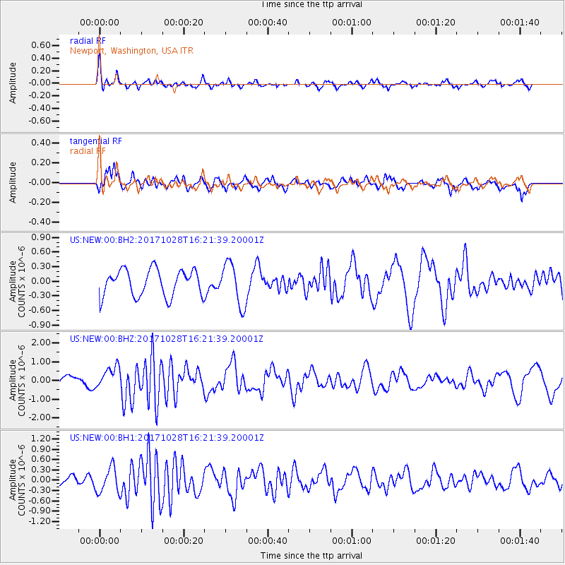
Signal To Noise
| Channel | StoN | STA | LTA |
| US:NEW:00:BHZ:20171028T16:21:39.20001Z | 1.6772164 | 5.8992947E-7 | 3.517313E-7 |
| US:NEW:00:BH1:20171028T16:21:39.20001Z | 3.1161985 | 3.7448694E-7 | 1.2017429E-7 |
| US:NEW:00:BH2:20171028T16:21:39.20001Z | 1.6700063 | 4.506463E-7 | 2.6984708E-7 |
| Arrivals |
| Ps | |
| PpPs | |
| PsPs/PpSs | |


