You are here: Home > Network List > US - United States National Seismic Network Stations List
> Station OGNE Ogallala, Nebraska, USA > Earthquake Result Viewer
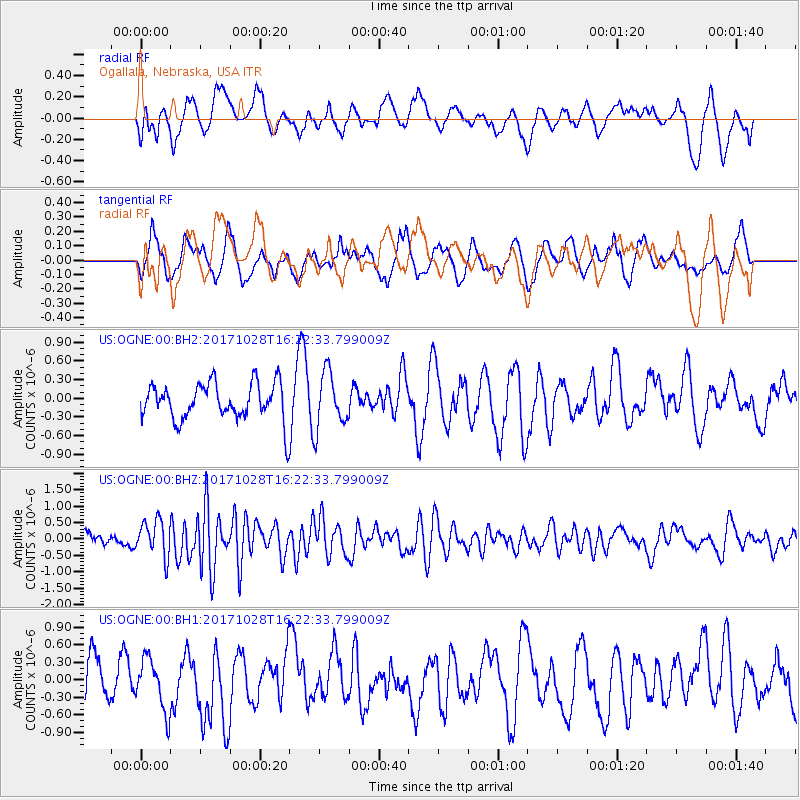
OGNE Ogallala, Nebraska, USA - Earthquake Result Viewer
*The percent match for this event was below the threshold and hence no stack was calculated.
| Earthquake location: |
North Of Franz Josef Land |
| Earthquake latitude/longitude: |
86.9/54.5 |
| Earthquake time(UTC): |
2017/10/28 (301) 16:13:54 GMT |
| Earthquake Depth: |
10 km |
| Earthquake Magnitude: |
5.8 Mww |
| Earthquake Catalog/Contributor: |
NEIC PDE/us |
|
| Network: |
US United States National Seismic Network |
| Station: |
OGNE Ogallala, Nebraska, USA |
| Lat/Lon: |
40.95 N/102.03 W |
| Elevation: |
1054 m |
|
| Distance: |
52.1 deg |
| Az: |
337.529 deg |
| Baz: |
1.579 deg |
| Ray Param: |
$rayparam |
*The percent match for this event was below the threshold and hence was not used in the summary stack. |
|
| Radial Match: |
50.371853 % |
| Radial Bump: |
400 |
| Transverse Match: |
42.54599 % |
| Transverse Bump: |
400 |
| SOD ConfigId: |
2364251 |
| Insert Time: |
2017-11-11 16:19:15.436 +0000 |
| GWidth: |
2.5 |
| Max Bumps: |
400 |
| Tol: |
0.001 |
|
Signal To Noise
| Channel | StoN | STA | LTA |
| US:OGNE:00:BHZ:20171028T16:22:33.799009Z | 3.5272784 | 5.505455E-7 | 1.5608224E-7 |
| US:OGNE:00:BH1:20171028T16:22:33.799009Z | 1.3125046 | 4.4321249E-7 | 3.376845E-7 |
| US:OGNE:00:BH2:20171028T16:22:33.799009Z | 1.521725 | 4.4874182E-7 | 2.948902E-7 |
| Arrivals |
| Ps | |
| PpPs | |
| PsPs/PpSs | |


