You are here: Home > Network List > WY - Yellowstone Wyoming Seismic Network Stations List
> Station YHR Hawk's Rest, WY, USA > Earthquake Result Viewer
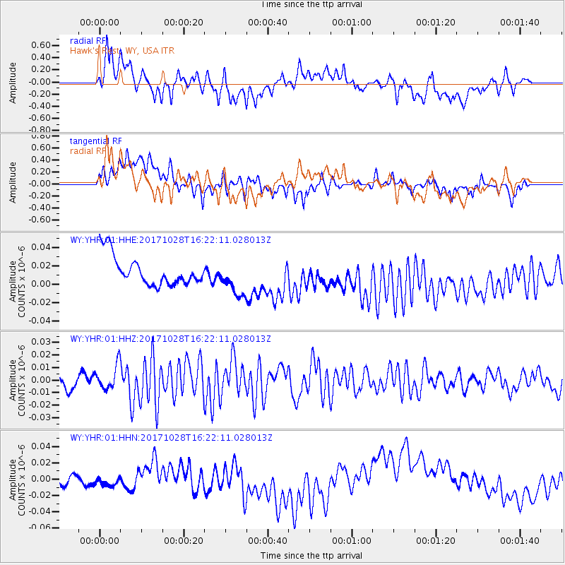
YHR Hawk's Rest, WY, USA - Earthquake Result Viewer
*The percent match for this event was below the threshold and hence no stack was calculated.
| Earthquake location: |
North Of Franz Josef Land |
| Earthquake latitude/longitude: |
86.9/54.5 |
| Earthquake time(UTC): |
2017/10/28 (301) 16:13:54 GMT |
| Earthquake Depth: |
10 km |
| Earthquake Magnitude: |
5.8 Mww |
| Earthquake Catalog/Contributor: |
NEIC PDE/us |
|
| Network: |
WY Yellowstone Wyoming Seismic Network |
| Station: |
YHR Hawk's Rest, WY, USA |
| Lat/Lon: |
44.11 N/110.08 W |
| Elevation: |
2976 m |
|
| Distance: |
49.1 deg |
| Az: |
345.32 deg |
| Baz: |
1.101 deg |
| Ray Param: |
$rayparam |
*The percent match for this event was below the threshold and hence was not used in the summary stack. |
|
| Radial Match: |
23.667324 % |
| Radial Bump: |
400 |
| Transverse Match: |
32.791595 % |
| Transverse Bump: |
400 |
| SOD ConfigId: |
2364251 |
| Insert Time: |
2017-11-11 16:20:13.287 +0000 |
| GWidth: |
2.5 |
| Max Bumps: |
400 |
| Tol: |
0.001 |
|
Signal To Noise
| Channel | StoN | STA | LTA |
| WY:YHR:01:HHZ:20171028T16:22:11.028013Z | 2.0546043 | 1.0053959E-8 | 4.89338E-9 |
| WY:YHR:01:HHN:20171028T16:22:11.028013Z | 0.68363214 | 1.9051644E-8 | 2.7868268E-8 |
| WY:YHR:01:HHE:20171028T16:22:11.028013Z | 1.2404927 | 1.945641E-8 | 1.568442E-8 |
| Arrivals |
| Ps | |
| PpPs | |
| PsPs/PpSs | |


