You are here: Home > Network List > US - United States National Seismic Network Stations List
> Station AMTX Amarillo, Texas, USA > Earthquake Result Viewer
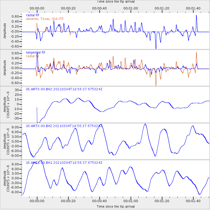
AMTX Amarillo, Texas, USA - Earthquake Result Viewer
*The percent match for this event was below the threshold and hence no stack was calculated.
| Earthquake location: |
Kermadec Islands Region |
| Earthquake latitude/longitude: |
-28.9/-176.9 |
| Earthquake time(UTC): |
2021/03/04 (063) 19:43:45 GMT |
| Earthquake Depth: |
10 km |
| Earthquake Magnitude: |
5.6 mb |
| Earthquake Catalog/Contributor: |
NEIC PDE/us |
|
| Network: |
US United States National Seismic Network |
| Station: |
AMTX Amarillo, Texas, USA |
| Lat/Lon: |
34.53 N/101.41 W |
| Elevation: |
1010 m |
|
| Distance: |
95.2 deg |
| Az: |
53.375 deg |
| Baz: |
238.453 deg |
| Ray Param: |
$rayparam |
*The percent match for this event was below the threshold and hence was not used in the summary stack. |
|
| Radial Match: |
64.28147 % |
| Radial Bump: |
400 |
| Transverse Match: |
66.40743 % |
| Transverse Bump: |
394 |
| SOD ConfigId: |
23341671 |
| Insert Time: |
2021-03-18 21:24:28.777 +0000 |
| GWidth: |
2.5 |
| Max Bumps: |
400 |
| Tol: |
0.001 |
|
Signal To Noise
| Channel | StoN | STA | LTA |
| US:AMTX:00:BHZ:20210304T19:56:37.675024Z | 1.4119439 | 6.665165E-6 | 4.7205594E-6 |
| US:AMTX:00:BH1:20210304T19:56:37.675024Z | 2.9153113 | 1.3886531E-5 | 4.7633093E-6 |
| US:AMTX:00:BH2:20210304T19:56:37.675024Z | 0.66945225 | 1.1106066E-5 | 1.658978E-5 |
| Arrivals |
| Ps | |
| PpPs | |
| PsPs/PpSs | |


