You are here: Home > Network List > CO - South Carolina Seismic Network Stations List
> Station SUMMV Summerville Airport, SC, USA > Earthquake Result Viewer
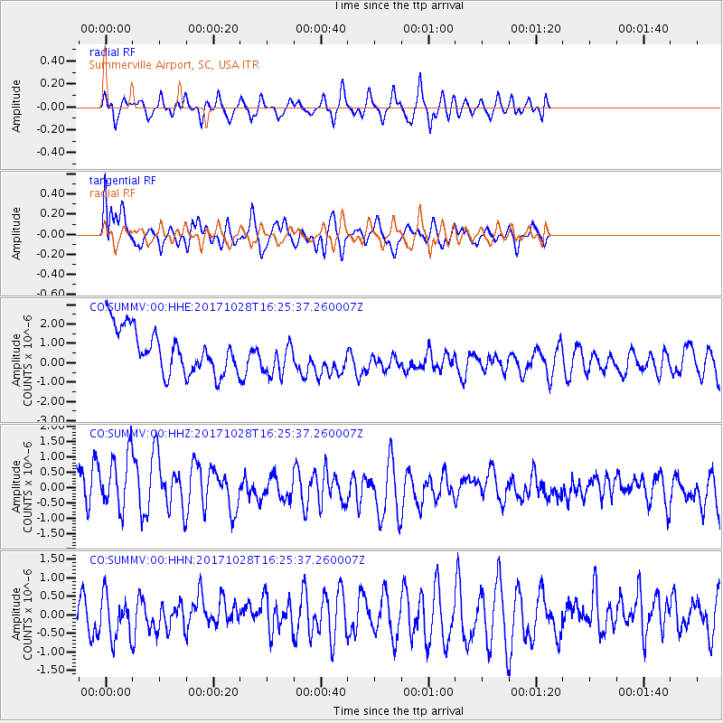
SUMMV Summerville Airport, SC, USA - Earthquake Result Viewer
*The percent match for this event was below the threshold and hence no stack was calculated.
| Earthquake location: |
North Of Franz Josef Land |
| Earthquake latitude/longitude: |
86.9/52.8 |
| Earthquake time(UTC): |
2017/10/28 (301) 16:16:06 GMT |
| Earthquake Depth: |
10 km |
| Earthquake Magnitude: |
5.8 Mww |
| Earthquake Catalog/Contributor: |
NEIC PDE/us |
|
| Network: |
CO South Carolina Seismic Network |
| Station: |
SUMMV Summerville Airport, SC, USA |
| Lat/Lon: |
33.07 N/80.27 W |
| Elevation: |
17 m |
|
| Distance: |
59.3 deg |
| Az: |
314.523 deg |
| Baz: |
2.656 deg |
| Ray Param: |
$rayparam |
*The percent match for this event was below the threshold and hence was not used in the summary stack. |
|
| Radial Match: |
71.46533 % |
| Radial Bump: |
400 |
| Transverse Match: |
72.425995 % |
| Transverse Bump: |
400 |
| SOD ConfigId: |
2364251 |
| Insert Time: |
2017-11-11 16:21:07.023 +0000 |
| GWidth: |
2.5 |
| Max Bumps: |
400 |
| Tol: |
0.001 |
|
Signal To Noise
| Channel | StoN | STA | LTA |
| CO:SUMMV:00:HHZ:20171028T16:25:37.260007Z | 1.2184789 | 1.1903161E-6 | 9.768869E-7 |
| CO:SUMMV:00:HHN:20171028T16:25:37.260007Z | 1.1705078 | 5.664623E-7 | 4.8394577E-7 |
| CO:SUMMV:00:HHE:20171028T16:25:37.260007Z | 0.8253521 | 9.31261E-7 | 1.1283197E-6 |
| Arrivals |
| Ps | |
| PpPs | |
| PsPs/PpSs | |


