You are here: Home > Network List > AV - Alaska Volcano Observatory Stations List
> Station SPCR Ckakachatna River, Mount Spurr, Alaska > Earthquake Result Viewer
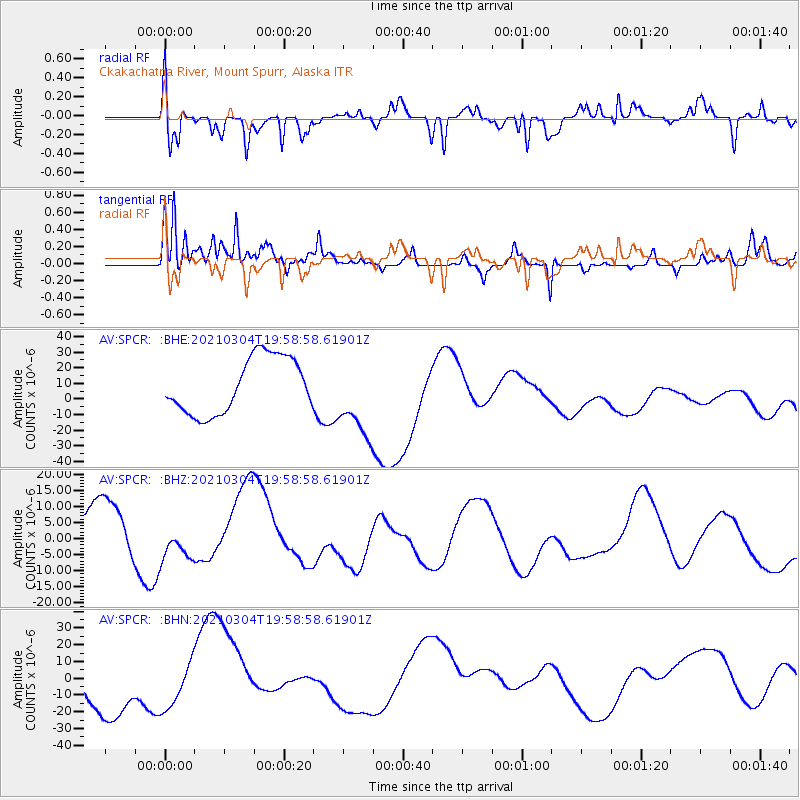
SPCR Ckakachatna River, Mount Spurr, Alaska - Earthquake Result Viewer
*The percent match for this event was below the threshold and hence no stack was calculated.
| Earthquake location: |
Kermadec Islands, New Zealand |
| Earthquake latitude/longitude: |
-29.8/-177.2 |
| Earthquake time(UTC): |
2021/03/04 (063) 19:46:17 GMT |
| Earthquake Depth: |
10 km |
| Earthquake Magnitude: |
5.7 mb |
| Earthquake Catalog/Contributor: |
NEIC PDE/us |
|
| Network: |
AV Alaska Volcano Observatory |
| Station: |
SPCR Ckakachatna River, Mount Spurr, Alaska |
| Lat/Lon: |
61.20 N/152.21 W |
| Elevation: |
984 m |
|
| Distance: |
92.9 deg |
| Az: |
11.829 deg |
| Baz: |
201.593 deg |
| Ray Param: |
$rayparam |
*The percent match for this event was below the threshold and hence was not used in the summary stack. |
|
| Radial Match: |
40.462257 % |
| Radial Bump: |
400 |
| Transverse Match: |
37.677982 % |
| Transverse Bump: |
330 |
| SOD ConfigId: |
23341671 |
| Insert Time: |
2021-03-18 21:29:24.788 +0000 |
| GWidth: |
2.5 |
| Max Bumps: |
400 |
| Tol: |
0.001 |
|
Signal To Noise
| Channel | StoN | STA | LTA |
| AV:SPCR: :BHZ:20210304T19:58:58.61901Z | 0.57405573 | 4.741934E-6 | 8.2604065E-6 |
| AV:SPCR: :BHN:20210304T19:58:58.61901Z | 0.91861373 | 1.3673092E-5 | 1.4884485E-5 |
| AV:SPCR: :BHE:20210304T19:58:58.61901Z | 1.4631946 | 2.5908983E-5 | 1.7707134E-5 |
| Arrivals |
| Ps | |
| PpPs | |
| PsPs/PpSs | |


