You are here: Home > Network List > TA - USArray Transportable Network (new EarthScope stations) Stations List
> Station L15K Ungalak Mountain, AK, USA > Earthquake Result Viewer
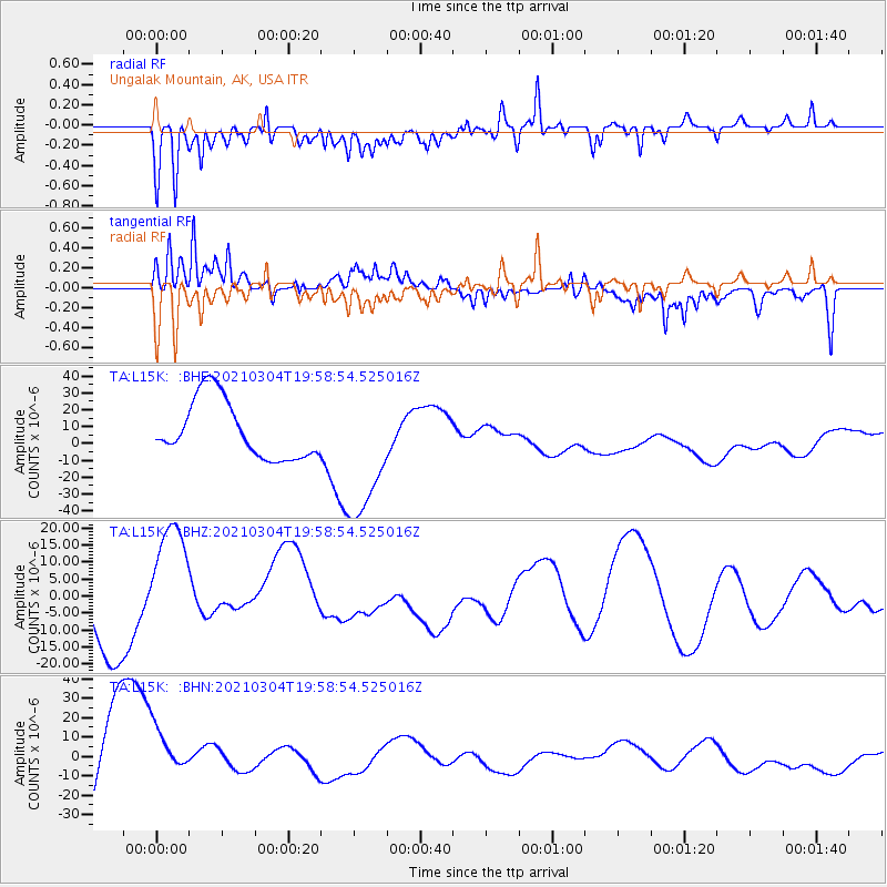
L15K Ungalak Mountain, AK, USA - Earthquake Result Viewer
*The percent match for this event was below the threshold and hence no stack was calculated.
| Earthquake location: |
Kermadec Islands, New Zealand |
| Earthquake latitude/longitude: |
-29.8/-177.2 |
| Earthquake time(UTC): |
2021/03/04 (063) 19:46:17 GMT |
| Earthquake Depth: |
10 km |
| Earthquake Magnitude: |
5.7 mb |
| Earthquake Catalog/Contributor: |
NEIC PDE/us |
|
| Network: |
TA USArray Transportable Network (new EarthScope stations) |
| Station: |
L15K Ungalak Mountain, AK, USA |
| Lat/Lon: |
61.68 N/161.49 W |
| Elevation: |
219 m |
|
| Distance: |
92.0 deg |
| Az: |
7.435 deg |
| Baz: |
193.643 deg |
| Ray Param: |
$rayparam |
*The percent match for this event was below the threshold and hence was not used in the summary stack. |
|
| Radial Match: |
44.66775 % |
| Radial Bump: |
400 |
| Transverse Match: |
46.651848 % |
| Transverse Bump: |
369 |
| SOD ConfigId: |
23341671 |
| Insert Time: |
2021-03-18 21:38:20.073 +0000 |
| GWidth: |
2.5 |
| Max Bumps: |
400 |
| Tol: |
0.001 |
|
Signal To Noise
| Channel | StoN | STA | LTA |
| TA:L15K: :BHZ:20210304T19:58:54.525016Z | 2.1060221 | 1.8796612E-5 | 8.9251735E-6 |
| TA:L15K: :BHN:20210304T19:58:54.525016Z | 0.6157866 | 1.6124808E-5 | 2.6185706E-5 |
| TA:L15K: :BHE:20210304T19:58:54.525016Z | 2.3316607 | 4.0017843E-5 | 1.7162807E-5 |
| Arrivals |
| Ps | |
| PpPs | |
| PsPs/PpSs | |


