You are here: Home > Network List > UU - University of Utah Regional Network Stations List
> Station FORU South Mineral Mountains, UT, USA > Earthquake Result Viewer
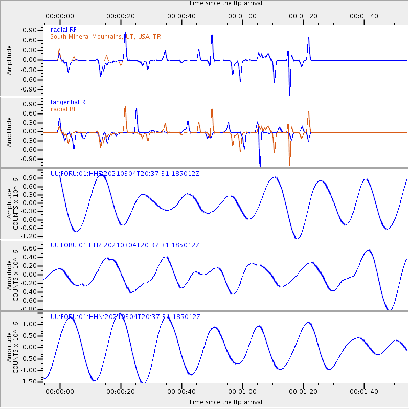
FORU South Mineral Mountains, UT, USA - Earthquake Result Viewer
*The percent match for this event was below the threshold and hence no stack was calculated.
| Earthquake location: |
Kermadec Islands Region |
| Earthquake latitude/longitude: |
-28.4/-176.6 |
| Earthquake time(UTC): |
2021/03/04 (063) 20:25:06 GMT |
| Earthquake Depth: |
10 km |
| Earthquake Magnitude: |
6.1 mb |
| Earthquake Catalog/Contributor: |
NEIC PDE/us |
|
| Network: |
UU University of Utah Regional Network |
| Station: |
FORU South Mineral Mountains, UT, USA |
| Lat/Lon: |
38.46 N/112.86 W |
| Elevation: |
1840 m |
|
| Distance: |
89.3 deg |
| Az: |
44.78 deg |
| Baz: |
232.228 deg |
| Ray Param: |
$rayparam |
*The percent match for this event was below the threshold and hence was not used in the summary stack. |
|
| Radial Match: |
90.372 % |
| Radial Bump: |
153 |
| Transverse Match: |
21.894909 % |
| Transverse Bump: |
140 |
| SOD ConfigId: |
23341671 |
| Insert Time: |
2021-03-18 22:10:09.815 +0000 |
| GWidth: |
2.5 |
| Max Bumps: |
400 |
| Tol: |
0.001 |
|
Signal To Noise
| Channel | StoN | STA | LTA |
| UU:FORU:01:HHZ:20210304T20:37:31.185012Z | 1.2212498 | 1.3120673E-7 | 1.0743644E-7 |
| UU:FORU:01:HHN:20210304T20:37:31.185012Z | 1.4693952 | 9.778898E-7 | 6.6550496E-7 |
| UU:FORU:01:HHE:20210304T20:37:31.185012Z | 0.25544262 | 1.702023E-7 | 6.6630344E-7 |
| Arrivals |
| Ps | |
| PpPs | |
| PsPs/PpSs | |


