You are here: Home > Network List > US - United States National Seismic Network Stations List
> Station SCIA State Center, Iowa, USA > Earthquake Result Viewer
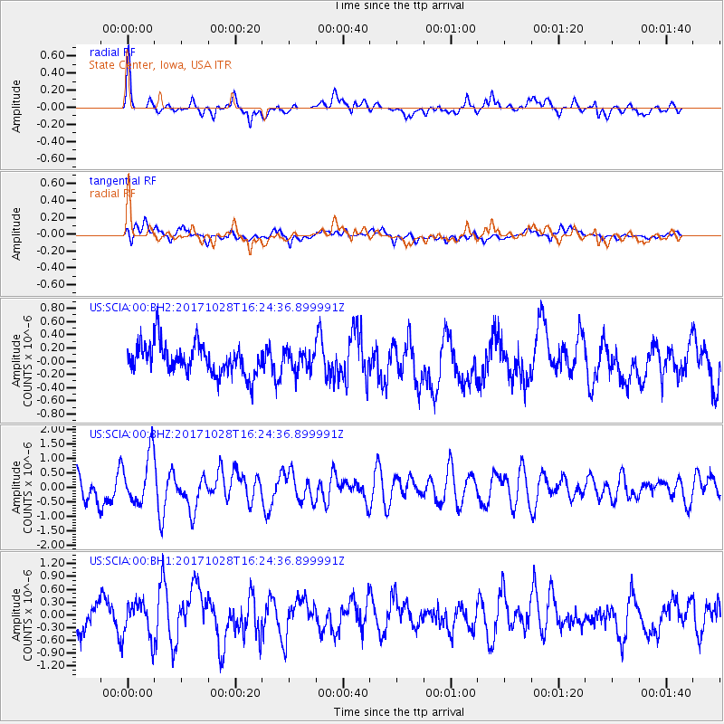
SCIA State Center, Iowa, USA - Earthquake Result Viewer
*The percent match for this event was below the threshold and hence no stack was calculated.
| Earthquake location: |
North Of Franz Josef Land |
| Earthquake latitude/longitude: |
86.9/52.8 |
| Earthquake time(UTC): |
2017/10/28 (301) 16:16:06 GMT |
| Earthquake Depth: |
10 km |
| Earthquake Magnitude: |
5.8 Mww |
| Earthquake Catalog/Contributor: |
NEIC PDE/us |
|
| Network: |
US United States National Seismic Network |
| Station: |
SCIA State Center, Iowa, USA |
| Lat/Lon: |
41.91 N/93.22 W |
| Elevation: |
312 m |
|
| Distance: |
50.9 deg |
| Az: |
327.523 deg |
| Baz: |
2.25 deg |
| Ray Param: |
$rayparam |
*The percent match for this event was below the threshold and hence was not used in the summary stack. |
|
| Radial Match: |
72.67056 % |
| Radial Bump: |
400 |
| Transverse Match: |
41.419933 % |
| Transverse Bump: |
400 |
| SOD ConfigId: |
2364251 |
| Insert Time: |
2017-11-11 16:24:51.969 +0000 |
| GWidth: |
2.5 |
| Max Bumps: |
400 |
| Tol: |
0.001 |
|
Signal To Noise
| Channel | StoN | STA | LTA |
| US:SCIA:00:BHZ:20171028T16:24:36.899991Z | 2.3881211 | 8.59806E-7 | 3.6003448E-7 |
| US:SCIA:00:BH1:20171028T16:24:36.899991Z | 1.3595535 | 4.4382065E-7 | 3.264459E-7 |
| US:SCIA:00:BH2:20171028T16:24:36.899991Z | 0.6211493 | 1.4465031E-7 | 2.3287528E-7 |
| Arrivals |
| Ps | |
| PpPs | |
| PsPs/PpSs | |


