You are here: Home > Network List > TA - USArray Transportable Network (new EarthScope stations) Stations List
> Station G21K Allakaket, AK, USA > Earthquake Result Viewer
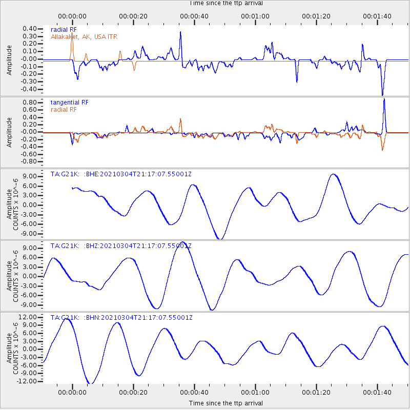
G21K Allakaket, AK, USA - Earthquake Result Viewer
*The percent match for this event was below the threshold and hence no stack was calculated.
| Earthquake location: |
Kermadec Islands, New Zealand |
| Earthquake latitude/longitude: |
-29.4/-177.1 |
| Earthquake time(UTC): |
2021/03/04 (063) 21:04:06 GMT |
| Earthquake Depth: |
10 km |
| Earthquake Magnitude: |
5.8 mb |
| Earthquake Catalog/Contributor: |
NEIC PDE/us |
|
| Network: |
TA USArray Transportable Network (new EarthScope stations) |
| Station: |
G21K Allakaket, AK, USA |
| Lat/Lon: |
66.52 N/153.51 W |
| Elevation: |
446 m |
|
| Distance: |
97.3 deg |
| Az: |
9.311 deg |
| Baz: |
200.626 deg |
| Ray Param: |
$rayparam |
*The percent match for this event was below the threshold and hence was not used in the summary stack. |
|
| Radial Match: |
58.275288 % |
| Radial Bump: |
400 |
| Transverse Match: |
45.123695 % |
| Transverse Bump: |
400 |
| SOD ConfigId: |
23341671 |
| Insert Time: |
2021-03-18 22:30:23.666 +0000 |
| GWidth: |
2.5 |
| Max Bumps: |
400 |
| Tol: |
0.001 |
|
Signal To Noise
| Channel | StoN | STA | LTA |
| TA:G21K: :BHZ:20210304T21:17:07.55001Z | 0.2852318 | 1.2461455E-6 | 4.3688874E-6 |
| TA:G21K: :BHN:20210304T21:17:07.55001Z | 2.1734784 | 7.785578E-6 | 3.5820826E-6 |
| TA:G21K: :BHE:20210304T21:17:07.55001Z | 2.39447 | 6.8218483E-6 | 2.8490012E-6 |
| Arrivals |
| Ps | |
| PpPs | |
| PsPs/PpSs | |


