You are here: Home > Network List > TA - USArray Transportable Network (new EarthScope stations) Stations List
> Station L15K Ungalak Mountain, AK, USA > Earthquake Result Viewer
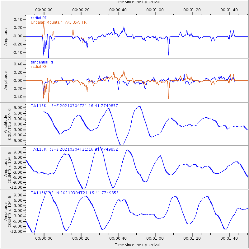
L15K Ungalak Mountain, AK, USA - Earthquake Result Viewer
*The percent match for this event was below the threshold and hence no stack was calculated.
| Earthquake location: |
Kermadec Islands, New Zealand |
| Earthquake latitude/longitude: |
-29.4/-177.1 |
| Earthquake time(UTC): |
2021/03/04 (063) 21:04:06 GMT |
| Earthquake Depth: |
10 km |
| Earthquake Magnitude: |
5.8 mb |
| Earthquake Catalog/Contributor: |
NEIC PDE/us |
|
| Network: |
TA USArray Transportable Network (new EarthScope stations) |
| Station: |
L15K Ungalak Mountain, AK, USA |
| Lat/Lon: |
61.68 N/161.49 W |
| Elevation: |
219 m |
|
| Distance: |
91.6 deg |
| Az: |
7.382 deg |
| Baz: |
193.597 deg |
| Ray Param: |
$rayparam |
*The percent match for this event was below the threshold and hence was not used in the summary stack. |
|
| Radial Match: |
67.19525 % |
| Radial Bump: |
314 |
| Transverse Match: |
46.424297 % |
| Transverse Bump: |
400 |
| SOD ConfigId: |
23341671 |
| Insert Time: |
2021-03-18 22:30:30.359 +0000 |
| GWidth: |
2.5 |
| Max Bumps: |
400 |
| Tol: |
0.001 |
|
Signal To Noise
| Channel | StoN | STA | LTA |
| TA:L15K: :BHZ:20210304T21:16:41.774985Z | 0.7224741 | 4.242631E-6 | 5.872364E-6 |
| TA:L15K: :BHN:20210304T21:16:41.774985Z | 2.0109673 | 1.0901248E-5 | 5.4208977E-6 |
| TA:L15K: :BHE:20210304T21:16:41.774985Z | 1.3299932 | 4.914342E-6 | 3.6950125E-6 |
| Arrivals |
| Ps | |
| PpPs | |
| PsPs/PpSs | |


