You are here: Home > Network List > IU - Global Seismograph Network (GSN - IRIS/USGS) Stations List
> Station PMG Port Moresby, New Guinea > Earthquake Result Viewer
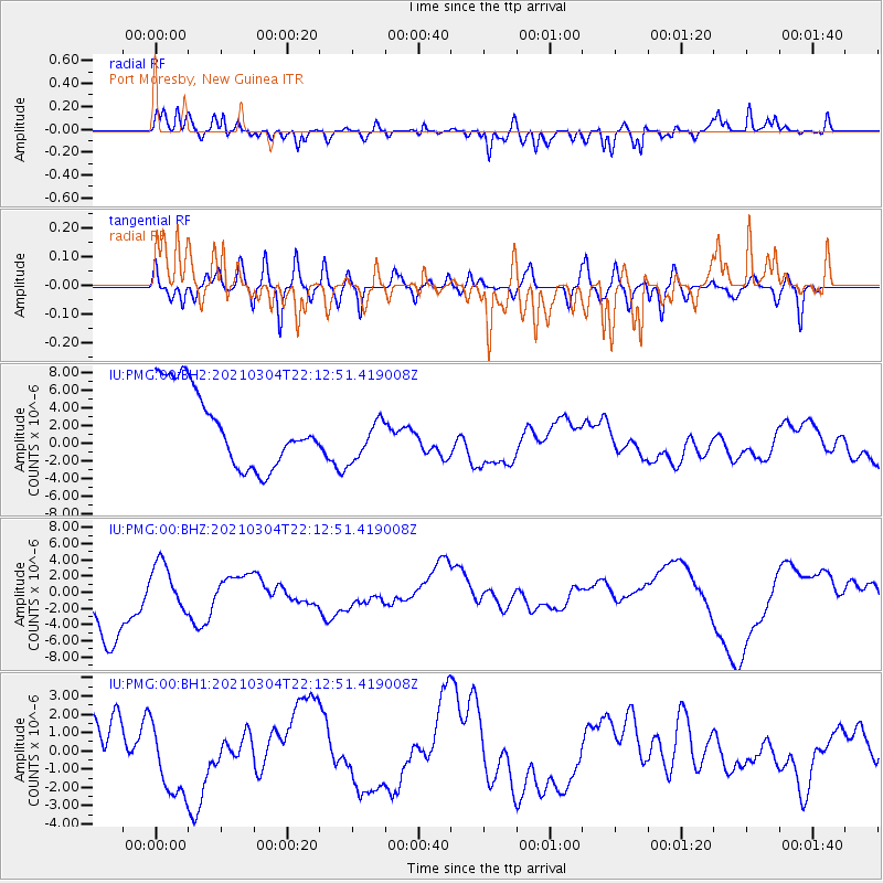
PMG Port Moresby, New Guinea - Earthquake Result Viewer
*The percent match for this event was below the threshold and hence no stack was calculated.
| Earthquake location: |
Kermadec Islands Region |
| Earthquake latitude/longitude: |
-28.6/-176.7 |
| Earthquake time(UTC): |
2021/03/04 (063) 22:05:56 GMT |
| Earthquake Depth: |
10 km |
| Earthquake Magnitude: |
5.5 mb |
| Earthquake Catalog/Contributor: |
NEIC PDE/us |
|
| Network: |
IU Global Seismograph Network (GSN - IRIS/USGS) |
| Station: |
PMG Port Moresby, New Guinea |
| Lat/Lon: |
9.40 S/147.16 E |
| Elevation: |
90 m |
|
| Distance: |
38.9 deg |
| Az: |
292.084 deg |
| Baz: |
124.32 deg |
| Ray Param: |
$rayparam |
*The percent match for this event was below the threshold and hence was not used in the summary stack. |
|
| Radial Match: |
59.22543 % |
| Radial Bump: |
364 |
| Transverse Match: |
35.98594 % |
| Transverse Bump: |
400 |
| SOD ConfigId: |
23341671 |
| Insert Time: |
2021-03-18 23:15:10.896 +0000 |
| GWidth: |
2.5 |
| Max Bumps: |
400 |
| Tol: |
0.001 |
|
Signal To Noise
| Channel | StoN | STA | LTA |
| IU:PMG:00:BHZ:20210304T22:12:51.419008Z | 0.555231 | 2.6187588E-6 | 4.7165217E-6 |
| IU:PMG:00:BH1:20210304T22:12:51.419008Z | 0.54202366 | 1.6700587E-6 | 3.0811548E-6 |
| IU:PMG:00:BH2:20210304T22:12:51.419008Z | 0.59796476 | 2.5703596E-6 | 4.2985134E-6 |
| Arrivals |
| Ps | |
| PpPs | |
| PsPs/PpSs | |


