You are here: Home > Network List > G - GEOSCOPE Stations List
> Station MPG Montagne des Peres, French Guyana > Earthquake Result Viewer
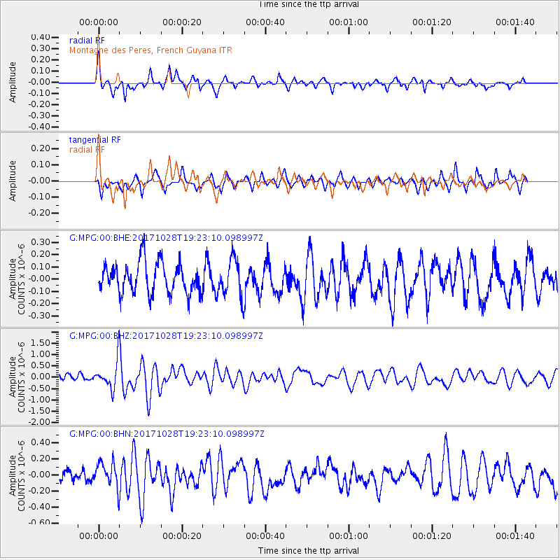
MPG Montagne des Peres, French Guyana - Earthquake Result Viewer
*The percent match for this event was below the threshold and hence no stack was calculated.
| Earthquake location: |
North Of Franz Josef Land |
| Earthquake latitude/longitude: |
86.9/55.1 |
| Earthquake time(UTC): |
2017/10/28 (301) 19:11:01 GMT |
| Earthquake Depth: |
10 km |
| Earthquake Magnitude: |
6.0 Mww |
| Earthquake Catalog/Contributor: |
NEIC PDE/us |
|
| Network: |
G GEOSCOPE |
| Station: |
MPG Montagne des Peres, French Guyana |
| Lat/Lon: |
5.11 N/52.64 W |
| Elevation: |
147 m |
|
| Distance: |
85.9 deg |
| Az: |
288.018 deg |
| Baz: |
2.986 deg |
| Ray Param: |
$rayparam |
*The percent match for this event was below the threshold and hence was not used in the summary stack. |
|
| Radial Match: |
70.952866 % |
| Radial Bump: |
328 |
| Transverse Match: |
57.747242 % |
| Transverse Bump: |
400 |
| SOD ConfigId: |
2364251 |
| Insert Time: |
2017-11-11 19:12:31.665 +0000 |
| GWidth: |
2.5 |
| Max Bumps: |
400 |
| Tol: |
0.001 |
|
Signal To Noise
| Channel | StoN | STA | LTA |
| G:MPG:00:BHZ:20171028T19:23:10.098997Z | 4.3509073 | 6.330235E-7 | 1.454923E-7 |
| G:MPG:00:BHN:20171028T19:23:10.098997Z | 2.8043427 | 1.6780103E-7 | 5.983613E-8 |
| G:MPG:00:BHE:20171028T19:23:10.098997Z | 1.2830546 | 1.5812405E-7 | 1.2324033E-7 |
| Arrivals |
| Ps | |
| PpPs | |
| PsPs/PpSs | |


