You are here: Home > Network List > US - United States National Seismic Network Stations List
> Station HLID Hailey, Idaho, USA > Earthquake Result Viewer
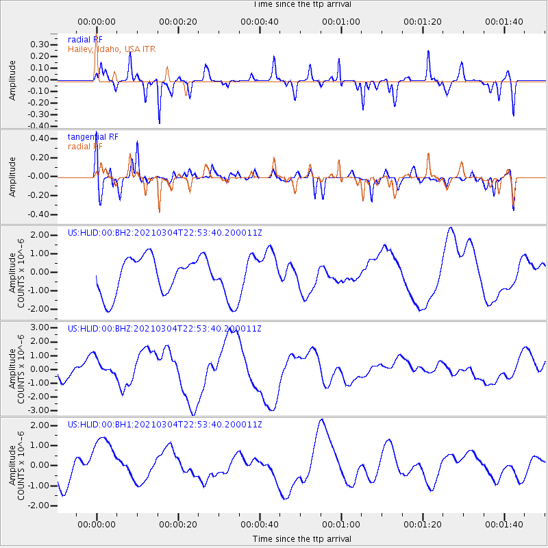
HLID Hailey, Idaho, USA - Earthquake Result Viewer
*The percent match for this event was below the threshold and hence no stack was calculated.
| Earthquake location: |
Kermadec Islands Region |
| Earthquake latitude/longitude: |
-28.4/-176.6 |
| Earthquake time(UTC): |
2021/03/04 (063) 22:41:05 GMT |
| Earthquake Depth: |
10 km |
| Earthquake Magnitude: |
5.8 mb |
| Earthquake Catalog/Contributor: |
NEIC PDE/us |
|
| Network: |
US United States National Seismic Network |
| Station: |
HLID Hailey, Idaho, USA |
| Lat/Lon: |
43.56 N/114.41 W |
| Elevation: |
1772 m |
|
| Distance: |
91.5 deg |
| Az: |
40.026 deg |
| Baz: |
231.237 deg |
| Ray Param: |
$rayparam |
*The percent match for this event was below the threshold and hence was not used in the summary stack. |
|
| Radial Match: |
74.87368 % |
| Radial Bump: |
247 |
| Transverse Match: |
60.26091 % |
| Transverse Bump: |
400 |
| SOD ConfigId: |
23341671 |
| Insert Time: |
2021-03-19 00:04:12.239 +0000 |
| GWidth: |
2.5 |
| Max Bumps: |
400 |
| Tol: |
0.001 |
|
Signal To Noise
| Channel | StoN | STA | LTA |
| US:HLID:00:BHZ:20210304T22:53:40.200011Z | 0.85550207 | 6.7843087E-7 | 7.930208E-7 |
| US:HLID:00:BH1:20210304T22:53:40.200011Z | 2.1723082 | 1.4852252E-6 | 6.837083E-7 |
| US:HLID:00:BH2:20210304T22:53:40.200011Z | 1.361396 | 1.3301263E-6 | 9.770313E-7 |
| Arrivals |
| Ps | |
| PpPs | |
| PsPs/PpSs | |


