You are here: Home > Network List > US - United States National Seismic Network Stations List
> Station MNTX Cornudas Mountains, Texas, USA > Earthquake Result Viewer
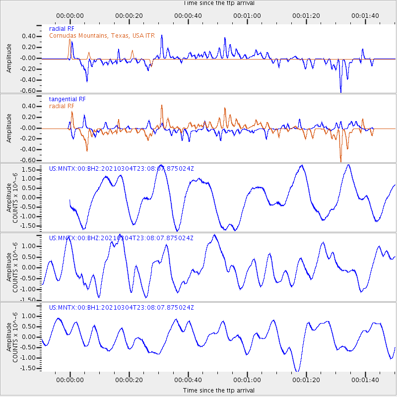
MNTX Cornudas Mountains, Texas, USA - Earthquake Result Viewer
*The percent match for this event was below the threshold and hence no stack was calculated.
| Earthquake location: |
Kermadec Islands Region |
| Earthquake latitude/longitude: |
-28.9/-176.4 |
| Earthquake time(UTC): |
2021/03/04 (063) 22:55:37 GMT |
| Earthquake Depth: |
10 km |
| Earthquake Magnitude: |
5.6 mb |
| Earthquake Catalog/Contributor: |
NEIC PDE/us |
|
| Network: |
US United States National Seismic Network |
| Station: |
MNTX Cornudas Mountains, Texas, USA |
| Lat/Lon: |
31.70 N/105.38 W |
| Elevation: |
404 m |
|
| Distance: |
90.5 deg |
| Az: |
53.707 deg |
| Baz: |
236.015 deg |
| Ray Param: |
$rayparam |
*The percent match for this event was below the threshold and hence was not used in the summary stack. |
|
| Radial Match: |
79.923904 % |
| Radial Bump: |
348 |
| Transverse Match: |
61.640766 % |
| Transverse Bump: |
344 |
| SOD ConfigId: |
23341671 |
| Insert Time: |
2021-03-19 00:19:14.326 +0000 |
| GWidth: |
2.5 |
| Max Bumps: |
400 |
| Tol: |
0.001 |
|
Signal To Noise
| Channel | StoN | STA | LTA |
| US:MNTX:00:BHZ:20210304T23:08:07.875024Z | 1.6221167 | 8.405159E-7 | 5.1815994E-7 |
| US:MNTX:00:BH1:20210304T23:08:07.875024Z | 1.3063558 | 6.774189E-7 | 5.1855613E-7 |
| US:MNTX:00:BH2:20210304T23:08:07.875024Z | 1.5100465 | 1.3795271E-6 | 9.13566E-7 |
| Arrivals |
| Ps | |
| PpPs | |
| PsPs/PpSs | |


