You are here: Home > Network List > IU - Global Seismograph Network (GSN - IRIS/USGS) Stations List
> Station CCM Cathedral Cave, Missouri, USA > Earthquake Result Viewer
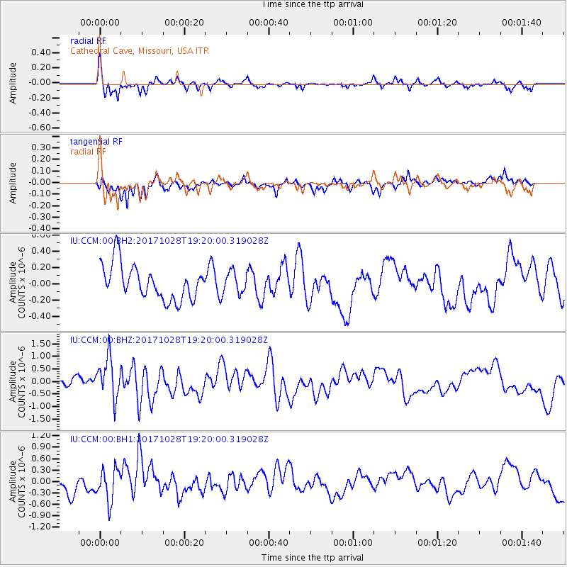
CCM Cathedral Cave, Missouri, USA - Earthquake Result Viewer
*The percent match for this event was below the threshold and hence no stack was calculated.
| Earthquake location: |
North Of Franz Josef Land |
| Earthquake latitude/longitude: |
86.9/55.1 |
| Earthquake time(UTC): |
2017/10/28 (301) 19:11:01 GMT |
| Earthquake Depth: |
10 km |
| Earthquake Magnitude: |
6.0 Mww |
| Earthquake Catalog/Contributor: |
NEIC PDE/us |
|
| Network: |
IU Global Seismograph Network (GSN - IRIS/USGS) |
| Station: |
CCM Cathedral Cave, Missouri, USA |
| Lat/Lon: |
38.06 N/91.24 W |
| Elevation: |
222 m |
|
| Distance: |
54.8 deg |
| Az: |
327.642 deg |
| Baz: |
2.12 deg |
| Ray Param: |
$rayparam |
*The percent match for this event was below the threshold and hence was not used in the summary stack. |
|
| Radial Match: |
74.40886 % |
| Radial Bump: |
353 |
| Transverse Match: |
64.21932 % |
| Transverse Bump: |
400 |
| SOD ConfigId: |
2364251 |
| Insert Time: |
2017-11-11 19:13:47.809 +0000 |
| GWidth: |
2.5 |
| Max Bumps: |
400 |
| Tol: |
0.001 |
|
Signal To Noise
| Channel | StoN | STA | LTA |
| IU:CCM:00:BHZ:20171028T19:20:00.319028Z | 4.1098146 | 8.408112E-7 | 2.0458617E-7 |
| IU:CCM:00:BH1:20171028T19:20:00.319028Z | 2.1927662 | 4.305387E-7 | 1.9634501E-7 |
| IU:CCM:00:BH2:20171028T19:20:00.319028Z | 0.6179725 | 1.3129538E-7 | 2.1246152E-7 |
| Arrivals |
| Ps | |
| PpPs | |
| PsPs/PpSs | |


