You are here: Home > Network List > CI - Caltech Regional Seismic Network Stations List
> Station MUR Murrieta > Earthquake Result Viewer
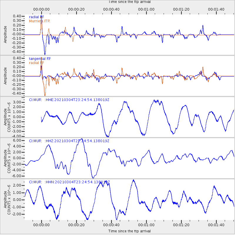
MUR Murrieta - Earthquake Result Viewer
*The percent match for this event was below the threshold and hence no stack was calculated.
| Earthquake location: |
Kermadec Islands Region |
| Earthquake latitude/longitude: |
-28.5/-176.6 |
| Earthquake time(UTC): |
2021/03/04 (063) 23:12:57 GMT |
| Earthquake Depth: |
10 km |
| Earthquake Magnitude: |
6.2 mb |
| Earthquake Catalog/Contributor: |
NEIC PDE/us |
|
| Network: |
CI Caltech Regional Seismic Network |
| Station: |
MUR Murrieta |
| Lat/Lon: |
33.60 N/117.20 W |
| Elevation: |
562 m |
|
| Distance: |
83.5 deg |
| Az: |
46.316 deg |
| Baz: |
229.708 deg |
| Ray Param: |
$rayparam |
*The percent match for this event was below the threshold and hence was not used in the summary stack. |
|
| Radial Match: |
87.21218 % |
| Radial Bump: |
346 |
| Transverse Match: |
71.084526 % |
| Transverse Bump: |
400 |
| SOD ConfigId: |
23341671 |
| Insert Time: |
2021-03-19 00:26:39.381 +0000 |
| GWidth: |
2.5 |
| Max Bumps: |
400 |
| Tol: |
0.001 |
|
Signal To Noise
| Channel | StoN | STA | LTA |
| CI:MUR: :HHZ:20210304T23:24:54.138019Z | 2.302735 | 3.1325524E-6 | 1.3603616E-6 |
| CI:MUR: :HHN:20210304T23:24:54.138019Z | 1.4672047 | 1.0850256E-6 | 7.395189E-7 |
| CI:MUR: :HHE:20210304T23:24:54.138019Z | 2.2646086 | 1.7099358E-6 | 7.55069E-7 |
| Arrivals |
| Ps | |
| PpPs | |
| PsPs/PpSs | |


