You are here: Home > Network List > IU - Global Seismograph Network (GSN - IRIS/USGS) Stations List
> Station RSSD Black Hills, South Dakota, USA > Earthquake Result Viewer
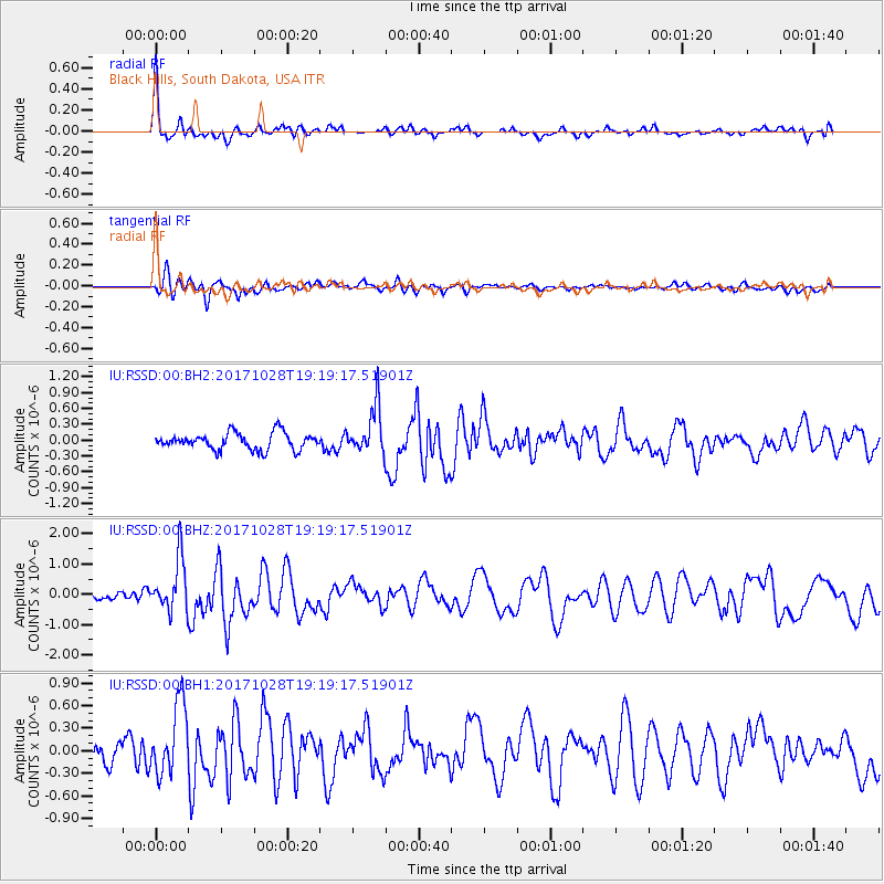
RSSD Black Hills, South Dakota, USA - Earthquake Result Viewer
*The percent match for this event was below the threshold and hence no stack was calculated.
| Earthquake location: |
North Of Franz Josef Land |
| Earthquake latitude/longitude: |
86.9/55.1 |
| Earthquake time(UTC): |
2017/10/28 (301) 19:11:01 GMT |
| Earthquake Depth: |
10 km |
| Earthquake Magnitude: |
6.0 Mww |
| Earthquake Catalog/Contributor: |
NEIC PDE/us |
|
| Network: |
IU Global Seismograph Network (GSN - IRIS/USGS) |
| Station: |
RSSD Black Hills, South Dakota, USA |
| Lat/Lon: |
44.12 N/104.04 W |
| Elevation: |
2090 m |
|
| Distance: |
49.0 deg |
| Az: |
340.165 deg |
| Baz: |
1.473 deg |
| Ray Param: |
$rayparam |
*The percent match for this event was below the threshold and hence was not used in the summary stack. |
|
| Radial Match: |
79.14299 % |
| Radial Bump: |
379 |
| Transverse Match: |
52.895878 % |
| Transverse Bump: |
400 |
| SOD ConfigId: |
2364251 |
| Insert Time: |
2017-11-11 19:14:03.977 +0000 |
| GWidth: |
2.5 |
| Max Bumps: |
400 |
| Tol: |
0.001 |
|
Signal To Noise
| Channel | StoN | STA | LTA |
| IU:RSSD:00:BHZ:20171028T19:19:17.51901Z | 7.0295014 | 8.710886E-7 | 1.2391898E-7 |
| IU:RSSD:00:BH1:20171028T19:19:17.51901Z | 2.6921694 | 4.7060632E-7 | 1.748056E-7 |
| IU:RSSD:00:BH2:20171028T19:19:17.51901Z | 2.8597946 | 4.4901495E-7 | 1.5700951E-7 |
| Arrivals |
| Ps | |
| PpPs | |
| PsPs/PpSs | |


