You are here: Home > Network List > IW - Intermountain West Stations List
> Station DLMT Dillon, Montana, USA > Earthquake Result Viewer
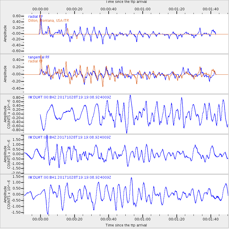
DLMT Dillon, Montana, USA - Earthquake Result Viewer
*The percent match for this event was below the threshold and hence no stack was calculated.
| Earthquake location: |
North Of Franz Josef Land |
| Earthquake latitude/longitude: |
86.9/55.1 |
| Earthquake time(UTC): |
2017/10/28 (301) 19:11:01 GMT |
| Earthquake Depth: |
10 km |
| Earthquake Magnitude: |
6.0 Mww |
| Earthquake Catalog/Contributor: |
NEIC PDE/us |
|
| Network: |
IW Intermountain West |
| Station: |
DLMT Dillon, Montana, USA |
| Lat/Lon: |
45.36 N/112.60 W |
| Elevation: |
1569 m |
|
| Distance: |
47.9 deg |
| Az: |
348.349 deg |
| Baz: |
0.895 deg |
| Ray Param: |
$rayparam |
*The percent match for this event was below the threshold and hence was not used in the summary stack. |
|
| Radial Match: |
69.29866 % |
| Radial Bump: |
313 |
| Transverse Match: |
68.80164 % |
| Transverse Bump: |
371 |
| SOD ConfigId: |
2364251 |
| Insert Time: |
2017-11-11 19:14:13.997 +0000 |
| GWidth: |
2.5 |
| Max Bumps: |
400 |
| Tol: |
0.001 |
|
Signal To Noise
| Channel | StoN | STA | LTA |
| IW:DLMT:00:BHZ:20171028T19:19:08.924009Z | 2.751847 | 7.1553234E-7 | 2.6001894E-7 |
| IW:DLMT:00:BH1:20171028T19:19:08.924009Z | 2.838583 | 7.202924E-7 | 2.537507E-7 |
| IW:DLMT:00:BH2:20171028T19:19:08.924009Z | 1.3201244 | 3.7787413E-7 | 2.8624132E-7 |
| Arrivals |
| Ps | |
| PpPs | |
| PsPs/PpSs | |


