You are here: Home > Network List > IW - Intermountain West Stations List
> Station PLID Pearl Lake, Idaho, USA > Earthquake Result Viewer
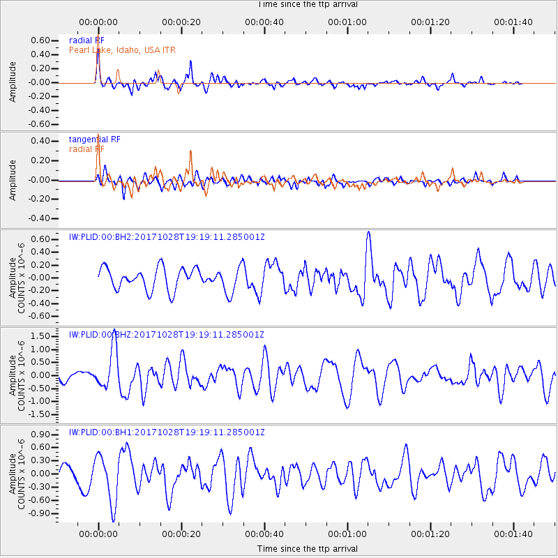
PLID Pearl Lake, Idaho, USA - Earthquake Result Viewer
*The percent match for this event was below the threshold and hence no stack was calculated.
| Earthquake location: |
North Of Franz Josef Land |
| Earthquake latitude/longitude: |
86.9/55.1 |
| Earthquake time(UTC): |
2017/10/28 (301) 19:11:01 GMT |
| Earthquake Depth: |
10 km |
| Earthquake Magnitude: |
6.0 Mww |
| Earthquake Catalog/Contributor: |
NEIC PDE/us |
|
| Network: |
IW Intermountain West |
| Station: |
PLID Pearl Lake, Idaho, USA |
| Lat/Lon: |
45.09 N/116.00 W |
| Elevation: |
2164 m |
|
| Distance: |
48.2 deg |
| Az: |
351.579 deg |
| Baz: |
0.646 deg |
| Ray Param: |
$rayparam |
*The percent match for this event was below the threshold and hence was not used in the summary stack. |
|
| Radial Match: |
70.99292 % |
| Radial Bump: |
394 |
| Transverse Match: |
48.482395 % |
| Transverse Bump: |
400 |
| SOD ConfigId: |
2364251 |
| Insert Time: |
2017-11-11 19:14:24.407 +0000 |
| GWidth: |
2.5 |
| Max Bumps: |
400 |
| Tol: |
0.001 |
|
Signal To Noise
| Channel | StoN | STA | LTA |
| IW:PLID:00:BHZ:20171028T19:19:11.285001Z | 6.0865917 | 8.1642344E-7 | 1.3413474E-7 |
| IW:PLID:00:BH1:20171028T19:19:11.285001Z | 4.009106 | 5.572049E-7 | 1.389848E-7 |
| IW:PLID:00:BH2:20171028T19:19:11.285001Z | 1.3312277 | 2.2375393E-7 | 1.6808089E-7 |
| Arrivals |
| Ps | |
| PpPs | |
| PsPs/PpSs | |


