You are here: Home > Network List > US - United States National Seismic Network Stations List
> Station MSO Missoula, Montana, USA > Earthquake Result Viewer
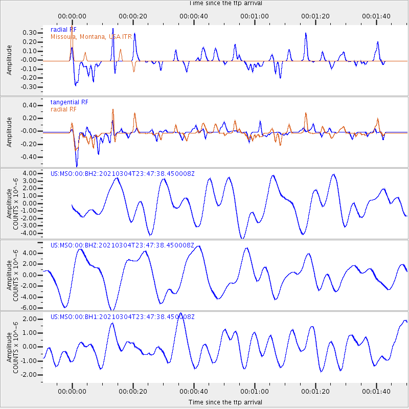
MSO Missoula, Montana, USA - Earthquake Result Viewer
*The percent match for this event was below the threshold and hence no stack was calculated.
| Earthquake location: |
Kermadec Islands Region |
| Earthquake latitude/longitude: |
-28.5/-176.2 |
| Earthquake time(UTC): |
2021/03/04 (063) 23:34:53 GMT |
| Earthquake Depth: |
10 km |
| Earthquake Magnitude: |
5.5 mb |
| Earthquake Catalog/Contributor: |
NEIC PDE/us |
|
| Network: |
US United States National Seismic Network |
| Station: |
MSO Missoula, Montana, USA |
| Lat/Lon: |
46.83 N/113.94 W |
| Elevation: |
1264 m |
|
| Distance: |
93.7 deg |
| Az: |
37.522 deg |
| Baz: |
231.323 deg |
| Ray Param: |
$rayparam |
*The percent match for this event was below the threshold and hence was not used in the summary stack. |
|
| Radial Match: |
77.98906 % |
| Radial Bump: |
400 |
| Transverse Match: |
74.65392 % |
| Transverse Bump: |
400 |
| SOD ConfigId: |
23341671 |
| Insert Time: |
2021-03-19 00:50:31.951 +0000 |
| GWidth: |
2.5 |
| Max Bumps: |
400 |
| Tol: |
0.001 |
|
Signal To Noise
| Channel | StoN | STA | LTA |
| US:MSO:00:BHZ:20210304T23:47:38.450008Z | 1.6310287 | 3.39532E-6 | 2.0817047E-6 |
| US:MSO:00:BH1:20210304T23:47:38.450008Z | 0.4737336 | 7.5971167E-7 | 1.6036686E-6 |
| US:MSO:00:BH2:20210304T23:47:38.450008Z | 1.3798535 | 2.2851739E-6 | 1.6560989E-6 |
| Arrivals |
| Ps | |
| PpPs | |
| PsPs/PpSs | |


