You are here: Home > Network List > AV - Alaska Volcano Observatory Stations List
> Station SPCR Ckakachatna River, Mount Spurr, Alaska > Earthquake Result Viewer
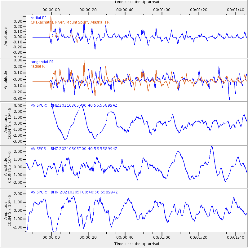
SPCR Ckakachatna River, Mount Spurr, Alaska - Earthquake Result Viewer
*The percent match for this event was below the threshold and hence no stack was calculated.
| Earthquake location: |
Kermadec Islands Region |
| Earthquake latitude/longitude: |
-29.0/-176.6 |
| Earthquake time(UTC): |
2021/03/05 (064) 00:28:19 GMT |
| Earthquake Depth: |
10 km |
| Earthquake Magnitude: |
5.9 mb |
| Earthquake Catalog/Contributor: |
NEIC PDE/us |
|
| Network: |
AV Alaska Volcano Observatory |
| Station: |
SPCR Ckakachatna River, Mount Spurr, Alaska |
| Lat/Lon: |
61.20 N/152.21 W |
| Elevation: |
984 m |
|
| Distance: |
92.0 deg |
| Az: |
11.524 deg |
| Baz: |
201.185 deg |
| Ray Param: |
$rayparam |
*The percent match for this event was below the threshold and hence was not used in the summary stack. |
|
| Radial Match: |
38.701206 % |
| Radial Bump: |
400 |
| Transverse Match: |
27.27495 % |
| Transverse Bump: |
384 |
| SOD ConfigId: |
23341671 |
| Insert Time: |
2021-03-19 01:38:54.959 +0000 |
| GWidth: |
2.5 |
| Max Bumps: |
400 |
| Tol: |
0.001 |
|
Signal To Noise
| Channel | StoN | STA | LTA |
| AV:SPCR: :BHZ:20210305T00:40:56.558994Z | 0.7913892 | 4.0708025E-7 | 5.143869E-7 |
| AV:SPCR: :BHN:20210305T00:40:56.558994Z | 2.118461 | 1.8529508E-6 | 8.7466844E-7 |
| AV:SPCR: :BHE:20210305T00:40:56.558994Z | 0.9395491 | 1.7078203E-6 | 1.817702E-6 |
| Arrivals |
| Ps | |
| PpPs | |
| PsPs/PpSs | |


