You are here: Home > Network List > TA - USArray Transportable Network (new EarthScope stations) Stations List
> Station TUL3 Leonard, OK, USA > Earthquake Result Viewer
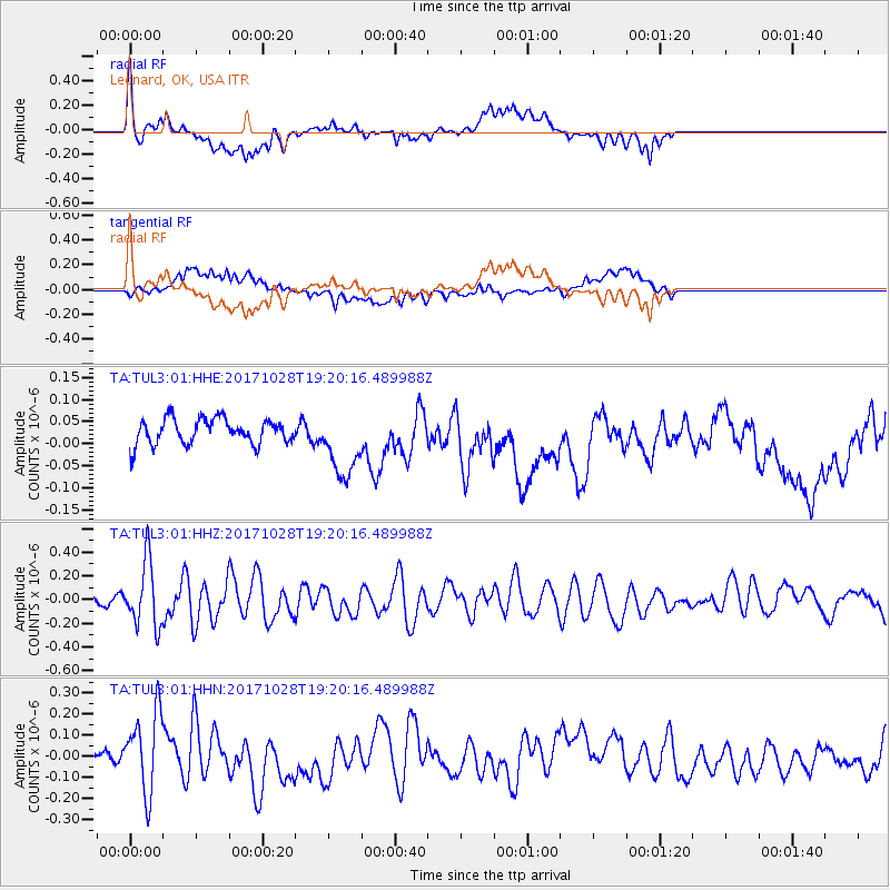
TUL3 Leonard, OK, USA - Earthquake Result Viewer
*The percent match for this event was below the threshold and hence no stack was calculated.
| Earthquake location: |
North Of Franz Josef Land |
| Earthquake latitude/longitude: |
86.9/55.1 |
| Earthquake time(UTC): |
2017/10/28 (301) 19:11:01 GMT |
| Earthquake Depth: |
10 km |
| Earthquake Magnitude: |
6.0 Mww |
| Earthquake Catalog/Contributor: |
NEIC PDE/us |
|
| Network: |
TA USArray Transportable Network (new EarthScope stations) |
| Station: |
TUL3 Leonard, OK, USA |
| Lat/Lon: |
35.91 N/95.79 W |
| Elevation: |
265 m |
|
| Distance: |
57.0 deg |
| Az: |
331.949 deg |
| Baz: |
1.811 deg |
| Ray Param: |
$rayparam |
*The percent match for this event was below the threshold and hence was not used in the summary stack. |
|
| Radial Match: |
73.805 % |
| Radial Bump: |
400 |
| Transverse Match: |
51.22734 % |
| Transverse Bump: |
400 |
| SOD ConfigId: |
2364251 |
| Insert Time: |
2017-11-11 19:15:30.567 +0000 |
| GWidth: |
2.5 |
| Max Bumps: |
400 |
| Tol: |
0.001 |
|
Signal To Noise
| Channel | StoN | STA | LTA |
| TA:TUL3:01:HHZ:20171028T19:20:16.489988Z | 5.938719 | 2.7181918E-7 | 4.5770676E-8 |
| TA:TUL3:01:HHN:20171028T19:20:16.489988Z | 2.2308972 | 1.8436302E-7 | 8.264075E-8 |
| TA:TUL3:01:HHE:20171028T19:20:16.489988Z | 2.6982892 | 7.798497E-8 | 2.8901635E-8 |
| Arrivals |
| Ps | |
| PpPs | |
| PsPs/PpSs | |


