You are here: Home > Network List > US - United States National Seismic Network Stations List
> Station ELK Elko, Nevada, USA > Earthquake Result Viewer
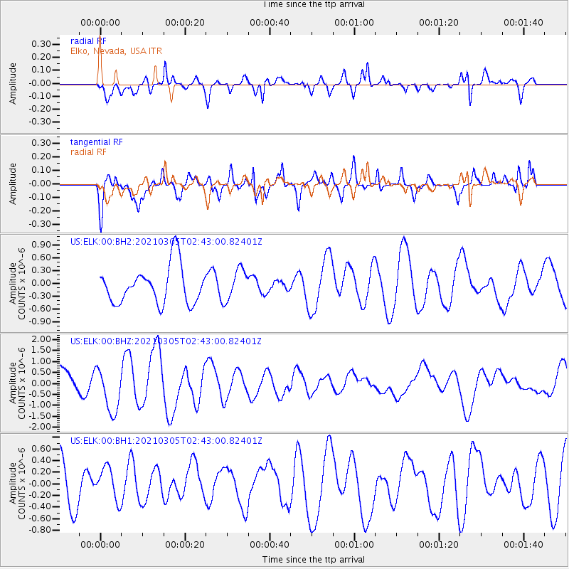
ELK Elko, Nevada, USA - Earthquake Result Viewer
*The percent match for this event was below the threshold and hence no stack was calculated.
| Earthquake location: |
Kermadec Islands Region |
| Earthquake latitude/longitude: |
-28.7/-176.5 |
| Earthquake time(UTC): |
2021/03/05 (064) 02:30:35 GMT |
| Earthquake Depth: |
10 km |
| Earthquake Magnitude: |
5.8 mb |
| Earthquake Catalog/Contributor: |
NEIC PDE/us |
|
| Network: |
US United States National Seismic Network |
| Station: |
ELK Elko, Nevada, USA |
| Lat/Lon: |
40.74 N/115.24 W |
| Elevation: |
2210 m |
|
| Distance: |
89.5 deg |
| Az: |
41.799 deg |
| Baz: |
230.394 deg |
| Ray Param: |
$rayparam |
*The percent match for this event was below the threshold and hence was not used in the summary stack. |
|
| Radial Match: |
64.160225 % |
| Radial Bump: |
400 |
| Transverse Match: |
66.89676 % |
| Transverse Bump: |
400 |
| SOD ConfigId: |
23341671 |
| Insert Time: |
2021-03-19 03:45:03.889 +0000 |
| GWidth: |
2.5 |
| Max Bumps: |
400 |
| Tol: |
0.001 |
|
Signal To Noise
| Channel | StoN | STA | LTA |
| US:ELK:00:BHZ:20210305T02:43:00.82401Z | 1.9187756 | 1.0387109E-6 | 5.4134046E-7 |
| US:ELK:00:BH1:20210305T02:43:00.82401Z | 0.7124721 | 3.00979E-7 | 4.224432E-7 |
| US:ELK:00:BH2:20210305T02:43:00.82401Z | 0.8435388 | 3.7135598E-7 | 4.4023577E-7 |
| Arrivals |
| Ps | |
| PpPs | |
| PsPs/PpSs | |


