You are here: Home > Network List > WY - Yellowstone Wyoming Seismic Network Stations List
> Station YHH Holmes Hill, YNP, WY, USA > Earthquake Result Viewer
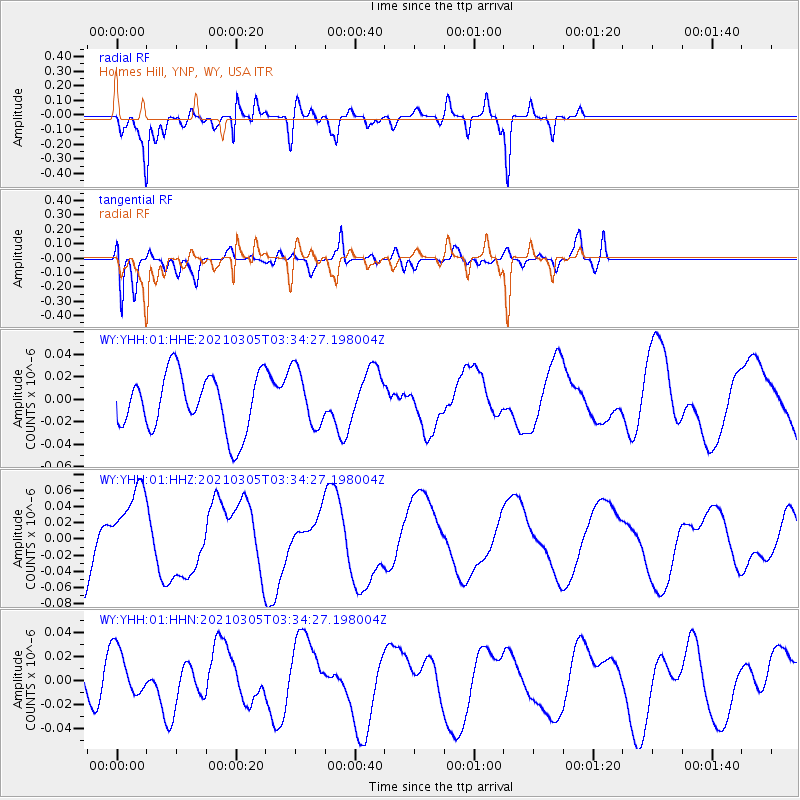
YHH Holmes Hill, YNP, WY, USA - Earthquake Result Viewer
*The percent match for this event was below the threshold and hence no stack was calculated.
| Earthquake location: |
Kermadec Islands Region |
| Earthquake latitude/longitude: |
-28.7/-176.6 |
| Earthquake time(UTC): |
2021/03/05 (064) 03:21:38 GMT |
| Earthquake Depth: |
10 km |
| Earthquake Magnitude: |
5.6 mb |
| Earthquake Catalog/Contributor: |
NEIC PDE/us |
|
| Network: |
WY Yellowstone Wyoming Seismic Network |
| Station: |
YHH Holmes Hill, YNP, WY, USA |
| Lat/Lon: |
44.79 N/110.85 W |
| Elevation: |
2717 m |
|
| Distance: |
94.4 deg |
| Az: |
40.614 deg |
| Baz: |
233.456 deg |
| Ray Param: |
$rayparam |
*The percent match for this event was below the threshold and hence was not used in the summary stack. |
|
| Radial Match: |
82.39097 % |
| Radial Bump: |
400 |
| Transverse Match: |
82.059456 % |
| Transverse Bump: |
400 |
| SOD ConfigId: |
23341671 |
| Insert Time: |
2021-03-19 04:36:54.423 +0000 |
| GWidth: |
2.5 |
| Max Bumps: |
400 |
| Tol: |
0.001 |
|
Signal To Noise
| Channel | StoN | STA | LTA |
| WY:YHH:01:HHZ:20210305T03:34:27.198004Z | 1.5488962 | 5.169273E-8 | 3.3373915E-8 |
| WY:YHH:01:HHN:20210305T03:34:27.198004Z | 1.3836257 | 2.0515614E-8 | 1.482743E-8 |
| WY:YHH:01:HHE:20210305T03:34:27.198004Z | 1.0053768 | 2.546769E-8 | 2.5331488E-8 |
| Arrivals |
| Ps | |
| PpPs | |
| PsPs/PpSs | |


