You are here: Home > Network List > G - GEOSCOPE Stations List
> Station INU Inuyama, Japan > Earthquake Result Viewer
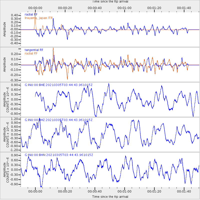
INU Inuyama, Japan - Earthquake Result Viewer
*The percent match for this event was below the threshold and hence no stack was calculated.
| Earthquake location: |
Kermadec Islands Region |
| Earthquake latitude/longitude: |
-28.8/-176.6 |
| Earthquake time(UTC): |
2021/03/05 (064) 03:33:20 GMT |
| Earthquake Depth: |
10 km |
| Earthquake Magnitude: |
5.6 mb |
| Earthquake Catalog/Contributor: |
NEIC PDE/us |
|
| Network: |
G GEOSCOPE |
| Station: |
INU Inuyama, Japan |
| Lat/Lon: |
35.35 N/137.03 E |
| Elevation: |
132 m |
|
| Distance: |
77.3 deg |
| Az: |
322.693 deg |
| Baz: |
139.394 deg |
| Ray Param: |
$rayparam |
*The percent match for this event was below the threshold and hence was not used in the summary stack. |
|
| Radial Match: |
85.5477 % |
| Radial Bump: |
400 |
| Transverse Match: |
54.297283 % |
| Transverse Bump: |
400 |
| SOD ConfigId: |
23341671 |
| Insert Time: |
2021-03-19 04:43:53.743 +0000 |
| GWidth: |
2.5 |
| Max Bumps: |
400 |
| Tol: |
0.001 |
|
Signal To Noise
| Channel | StoN | STA | LTA |
| G:INU:00:BHZ:20210305T03:44:43.961015Z | 1.3597412 | 8.6820415E-7 | 6.385069E-7 |
| G:INU:00:BHN:20210305T03:44:43.961015Z | 1.7264211 | 5.0993816E-7 | 2.9537298E-7 |
| G:INU:00:BHE:20210305T03:44:43.961015Z | 1.1554687 | 4.7908765E-7 | 4.1462624E-7 |
| Arrivals |
| Ps | |
| PpPs | |
| PsPs/PpSs | |


