You are here: Home > Network List > US - United States National Seismic Network Stations List
> Station DGMT Dagmar, Montana, USA > Earthquake Result Viewer
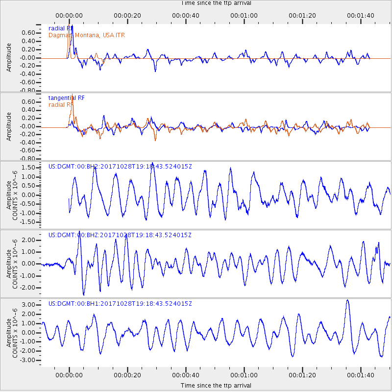
DGMT Dagmar, Montana, USA - Earthquake Result Viewer
*The percent match for this event was below the threshold and hence no stack was calculated.
| Earthquake location: |
North Of Franz Josef Land |
| Earthquake latitude/longitude: |
86.9/55.1 |
| Earthquake time(UTC): |
2017/10/28 (301) 19:11:01 GMT |
| Earthquake Depth: |
10 km |
| Earthquake Magnitude: |
6.0 Mww |
| Earthquake Catalog/Contributor: |
NEIC PDE/us |
|
| Network: |
US United States National Seismic Network |
| Station: |
DGMT Dagmar, Montana, USA |
| Lat/Lon: |
48.47 N/104.20 W |
| Elevation: |
0.0 m |
|
| Distance: |
44.7 deg |
| Az: |
340.475 deg |
| Baz: |
1.57 deg |
| Ray Param: |
$rayparam |
*The percent match for this event was below the threshold and hence was not used in the summary stack. |
|
| Radial Match: |
51.114597 % |
| Radial Bump: |
306 |
| Transverse Match: |
36.591595 % |
| Transverse Bump: |
322 |
| SOD ConfigId: |
2364251 |
| Insert Time: |
2017-11-11 19:16:52.045 +0000 |
| GWidth: |
2.5 |
| Max Bumps: |
400 |
| Tol: |
0.001 |
|
Signal To Noise
| Channel | StoN | STA | LTA |
| US:DGMT:00:BHZ:20171028T19:18:43.524015Z | 4.074333 | 1.1796939E-6 | 2.895428E-7 |
| US:DGMT:00:BH1:20171028T19:18:43.524015Z | 1.6542027 | 1.0053577E-6 | 6.077597E-7 |
| US:DGMT:00:BH2:20171028T19:18:43.524015Z | 1.1511986 | 8.157839E-7 | 7.0863865E-7 |
| Arrivals |
| Ps | |
| PpPs | |
| PsPs/PpSs | |


