You are here: Home > Network List > US - United States National Seismic Network Stations List
> Station EGMT Eagleton, Montana, USA > Earthquake Result Viewer
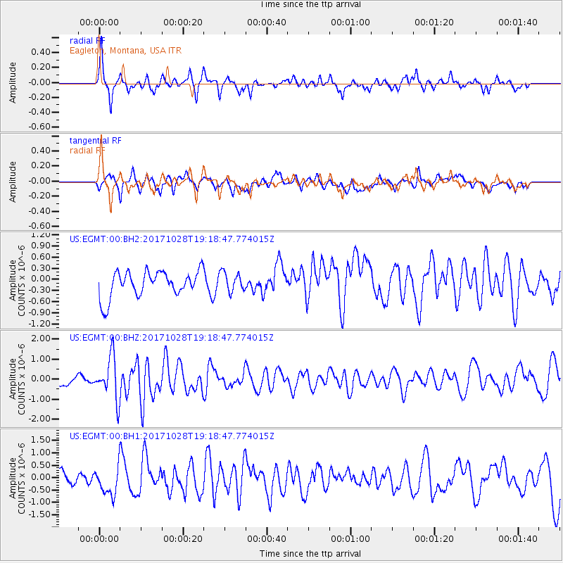
EGMT Eagleton, Montana, USA - Earthquake Result Viewer
*The percent match for this event was below the threshold and hence no stack was calculated.
| Earthquake location: |
North Of Franz Josef Land |
| Earthquake latitude/longitude: |
86.9/55.1 |
| Earthquake time(UTC): |
2017/10/28 (301) 19:11:01 GMT |
| Earthquake Depth: |
10 km |
| Earthquake Magnitude: |
6.0 Mww |
| Earthquake Catalog/Contributor: |
NEIC PDE/us |
|
| Network: |
US United States National Seismic Network |
| Station: |
EGMT Eagleton, Montana, USA |
| Lat/Lon: |
48.02 N/109.75 W |
| Elevation: |
1055 m |
|
| Distance: |
45.2 deg |
| Az: |
345.721 deg |
| Baz: |
1.149 deg |
| Ray Param: |
$rayparam |
*The percent match for this event was below the threshold and hence was not used in the summary stack. |
|
| Radial Match: |
72.46216 % |
| Radial Bump: |
400 |
| Transverse Match: |
61.429035 % |
| Transverse Bump: |
400 |
| SOD ConfigId: |
2364251 |
| Insert Time: |
2017-11-11 19:16:57.316 +0000 |
| GWidth: |
2.5 |
| Max Bumps: |
400 |
| Tol: |
0.001 |
|
Signal To Noise
| Channel | StoN | STA | LTA |
| US:EGMT:00:BHZ:20171028T19:18:47.774015Z | 4.192161 | 1.0896837E-6 | 2.599336E-7 |
| US:EGMT:00:BH1:20171028T19:18:47.774015Z | 1.4299697 | 5.594045E-7 | 3.9120027E-7 |
| US:EGMT:00:BH2:20171028T19:18:47.774015Z | 0.7316753 | 2.5733164E-7 | 3.5170197E-7 |
| Arrivals |
| Ps | |
| PpPs | |
| PsPs/PpSs | |


