You are here: Home > Network List > IU - Global Seismograph Network (GSN - IRIS/USGS) Stations List
> Station PMG Port Moresby, New Guinea > Earthquake Result Viewer
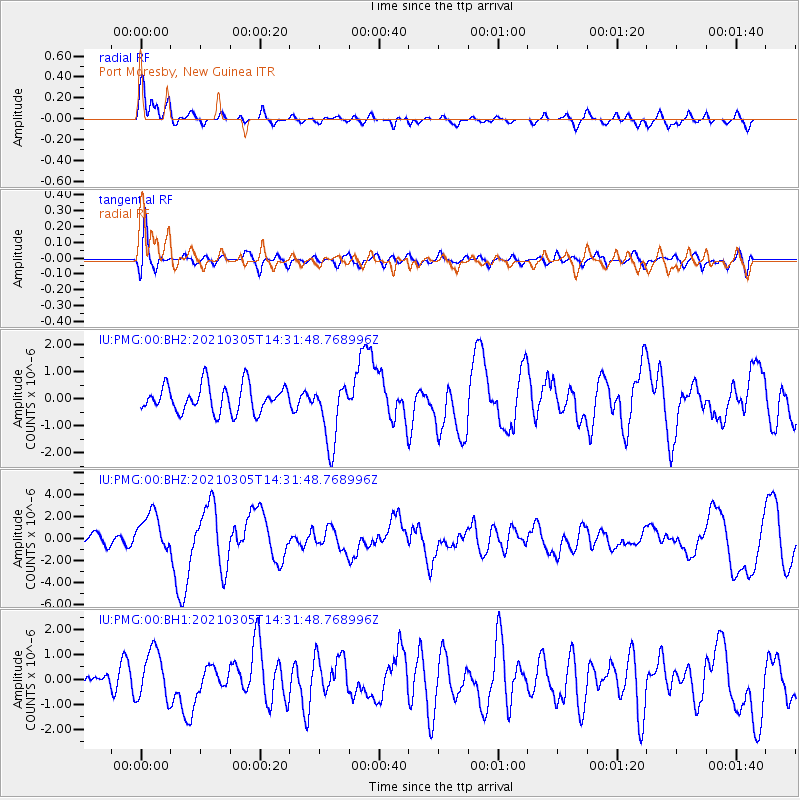
PMG Port Moresby, New Guinea - Earthquake Result Viewer
*The percent match for this event was below the threshold and hence no stack was calculated.
| Earthquake location: |
Kermadec Islands Region |
| Earthquake latitude/longitude: |
-29.1/-176.3 |
| Earthquake time(UTC): |
2021/03/05 (064) 14:24:49 GMT |
| Earthquake Depth: |
10 km |
| Earthquake Magnitude: |
6.2 Mww |
| Earthquake Catalog/Contributor: |
NEIC PDE/us |
|
| Network: |
IU Global Seismograph Network (GSN - IRIS/USGS) |
| Station: |
PMG Port Moresby, New Guinea |
| Lat/Lon: |
9.40 S/147.16 E |
| Elevation: |
90 m |
|
| Distance: |
39.4 deg |
| Az: |
292.343 deg |
| Baz: |
124.873 deg |
| Ray Param: |
$rayparam |
*The percent match for this event was below the threshold and hence was not used in the summary stack. |
|
| Radial Match: |
72.257065 % |
| Radial Bump: |
400 |
| Transverse Match: |
54.51529 % |
| Transverse Bump: |
400 |
| SOD ConfigId: |
23341671 |
| Insert Time: |
2021-03-19 15:36:56.723 +0000 |
| GWidth: |
2.5 |
| Max Bumps: |
400 |
| Tol: |
0.001 |
|
Signal To Noise
| Channel | StoN | STA | LTA |
| IU:PMG:00:BHZ:20210305T14:31:48.768996Z | 3.7462616 | 1.8042995E-6 | 4.8162667E-7 |
| IU:PMG:00:BH1:20210305T14:31:48.768996Z | 3.1398678 | 9.869517E-7 | 3.1432904E-7 |
| IU:PMG:00:BH2:20210305T14:31:48.768996Z | 2.359554 | 1.1694065E-6 | 4.9560487E-7 |
| Arrivals |
| Ps | |
| PpPs | |
| PsPs/PpSs | |


