You are here: Home > Network List > US - United States National Seismic Network Stations List
> Station WVOR Wild Horse Valley, Oregon, USA > Earthquake Result Viewer
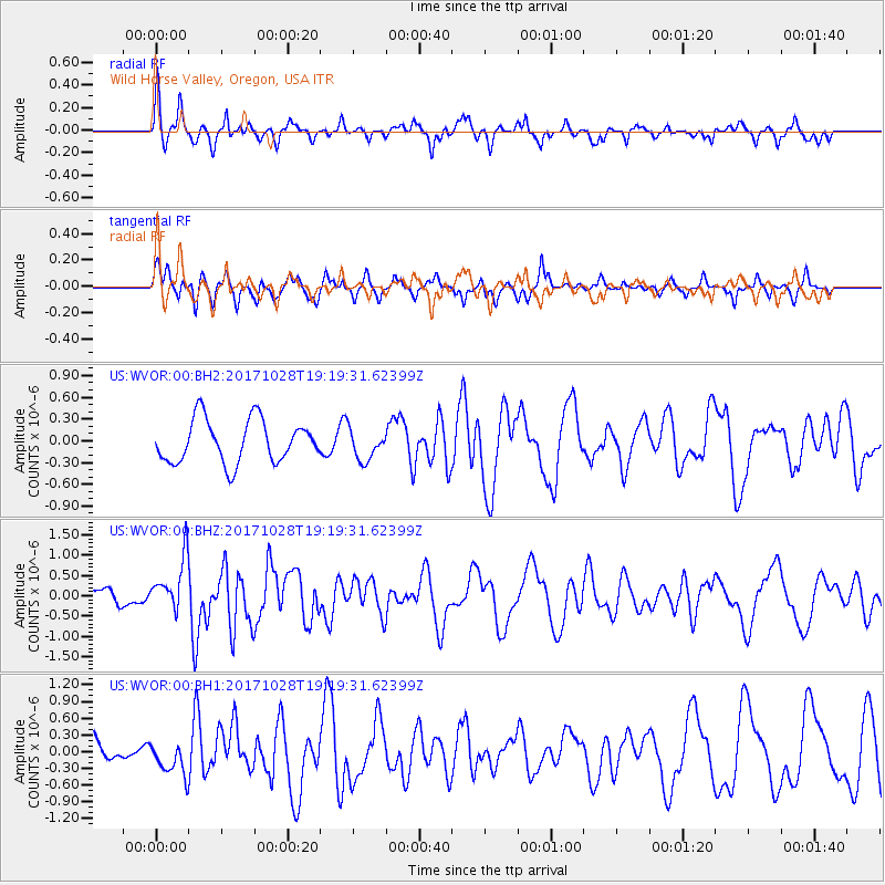
WVOR Wild Horse Valley, Oregon, USA - Earthquake Result Viewer
*The percent match for this event was below the threshold and hence no stack was calculated.
| Earthquake location: |
North Of Franz Josef Land |
| Earthquake latitude/longitude: |
86.9/55.1 |
| Earthquake time(UTC): |
2017/10/28 (301) 19:11:01 GMT |
| Earthquake Depth: |
10 km |
| Earthquake Magnitude: |
6.0 Mww |
| Earthquake Catalog/Contributor: |
NEIC PDE/us |
|
| Network: |
US United States National Seismic Network |
| Station: |
WVOR Wild Horse Valley, Oregon, USA |
| Lat/Lon: |
42.43 N/118.64 W |
| Elevation: |
1344 m |
|
| Distance: |
50.9 deg |
| Az: |
354.057 deg |
| Baz: |
0.437 deg |
| Ray Param: |
$rayparam |
*The percent match for this event was below the threshold and hence was not used in the summary stack. |
|
| Radial Match: |
72.42889 % |
| Radial Bump: |
326 |
| Transverse Match: |
62.49026 % |
| Transverse Bump: |
365 |
| SOD ConfigId: |
2364251 |
| Insert Time: |
2017-11-11 19:17:46.676 +0000 |
| GWidth: |
2.5 |
| Max Bumps: |
400 |
| Tol: |
0.001 |
|
Signal To Noise
| Channel | StoN | STA | LTA |
| US:WVOR:00:BHZ:20171028T19:19:31.62399Z | 3.030281 | 6.4781E-7 | 2.1377885E-7 |
| US:WVOR:00:BH1:20171028T19:19:31.62399Z | 1.5426308 | 2.9862255E-7 | 1.9358005E-7 |
| US:WVOR:00:BH2:20171028T19:19:31.62399Z | 0.71239656 | 2.0887627E-7 | 2.9320225E-7 |
| Arrivals |
| Ps | |
| PpPs | |
| PsPs/PpSs | |


