You are here: Home > Network List > TA - USArray Transportable Network (new EarthScope stations) Stations List
> Station I17K Unalakleet, AK, USA > Earthquake Result Viewer
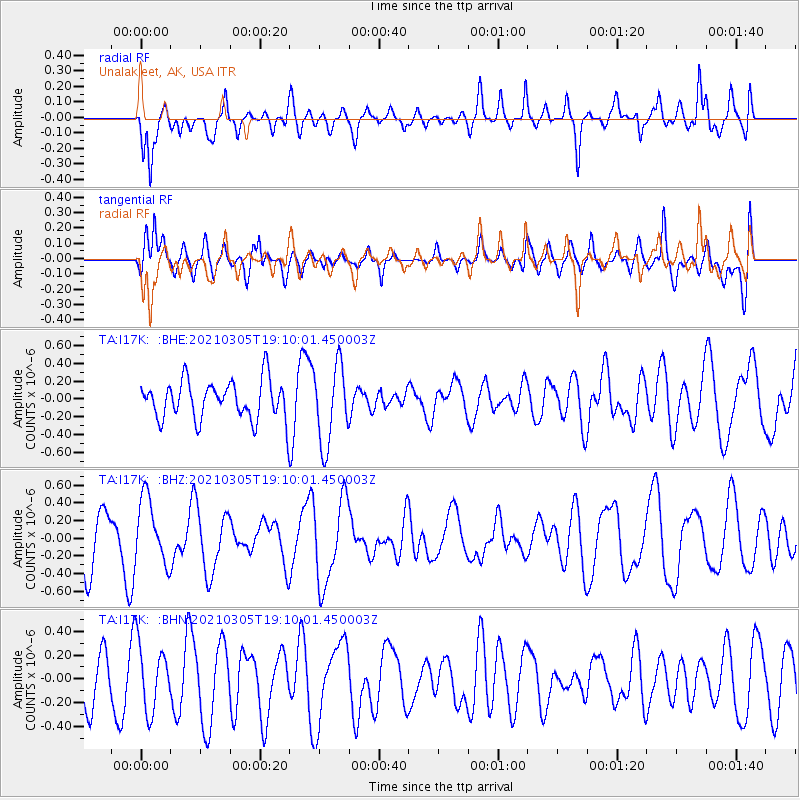
I17K Unalakleet, AK, USA - Earthquake Result Viewer
*The percent match for this event was below the threshold and hence no stack was calculated.
| Earthquake location: |
Kermadec Islands Region |
| Earthquake latitude/longitude: |
-28.4/-176.6 |
| Earthquake time(UTC): |
2021/03/05 (064) 18:57:20 GMT |
| Earthquake Depth: |
10 km |
| Earthquake Magnitude: |
5.5 mww |
| Earthquake Catalog/Contributor: |
NEIC PDE/us |
|
| Network: |
TA USArray Transportable Network (new EarthScope stations) |
| Station: |
I17K Unalakleet, AK, USA |
| Lat/Lon: |
63.89 N/160.70 W |
| Elevation: |
105 m |
|
| Distance: |
92.9 deg |
| Az: |
6.972 deg |
| Baz: |
193.98 deg |
| Ray Param: |
$rayparam |
*The percent match for this event was below the threshold and hence was not used in the summary stack. |
|
| Radial Match: |
63.973064 % |
| Radial Bump: |
400 |
| Transverse Match: |
55.52896 % |
| Transverse Bump: |
400 |
| SOD ConfigId: |
23341671 |
| Insert Time: |
2021-03-19 20:09:02.601 +0000 |
| GWidth: |
2.5 |
| Max Bumps: |
400 |
| Tol: |
0.001 |
|
Signal To Noise
| Channel | StoN | STA | LTA |
| TA:I17K: :BHZ:20210305T19:10:01.450003Z | 1.315844 | 3.7554332E-7 | 2.8540111E-7 |
| TA:I17K: :BHN:20210305T19:10:01.450003Z | 0.74355704 | 2.774117E-7 | 3.730873E-7 |
| TA:I17K: :BHE:20210305T19:10:01.450003Z | 2.0481718 | 4.4604E-7 | 2.1777468E-7 |
| Arrivals |
| Ps | |
| PpPs | |
| PsPs/PpSs | |


