You are here: Home > Network List > G - GEOSCOPE Stations List
> Station INU Inuyama, Japan > Earthquake Result Viewer
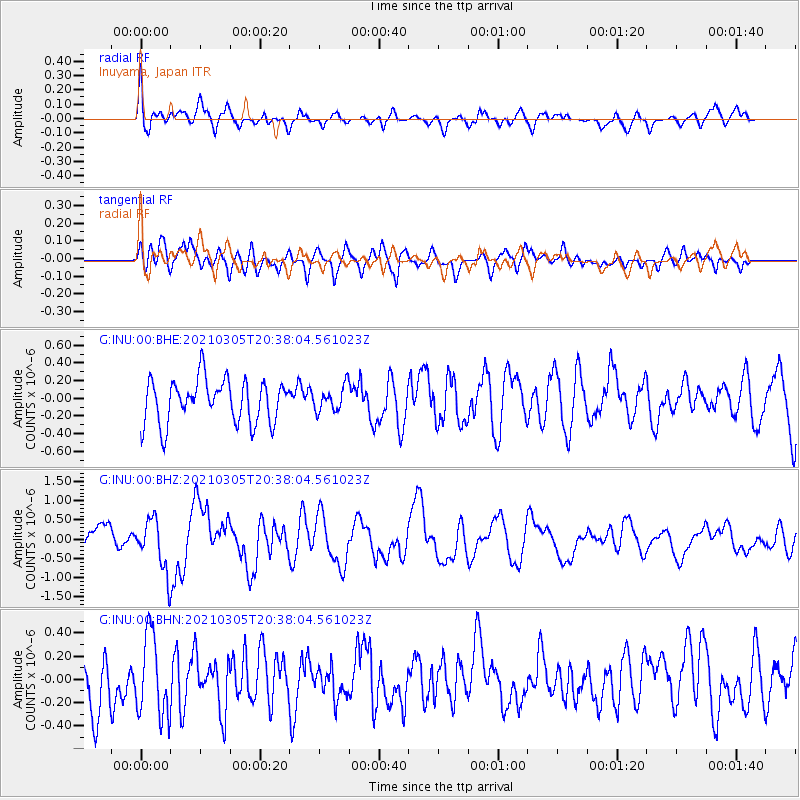
INU Inuyama, Japan - Earthquake Result Viewer
*The percent match for this event was below the threshold and hence no stack was calculated.
| Earthquake location: |
Kermadec Islands Region |
| Earthquake latitude/longitude: |
-30.2/-177.0 |
| Earthquake time(UTC): |
2021/03/05 (064) 20:26:35 GMT |
| Earthquake Depth: |
10 km |
| Earthquake Magnitude: |
5.8 mww |
| Earthquake Catalog/Contributor: |
NEIC PDE/us |
|
| Network: |
G GEOSCOPE |
| Station: |
INU Inuyama, Japan |
| Lat/Lon: |
35.35 N/137.03 E |
| Elevation: |
132 m |
|
| Distance: |
78.3 deg |
| Az: |
323.101 deg |
| Baz: |
140.526 deg |
| Ray Param: |
$rayparam |
*The percent match for this event was below the threshold and hence was not used in the summary stack. |
|
| Radial Match: |
68.96281 % |
| Radial Bump: |
400 |
| Transverse Match: |
54.47857 % |
| Transverse Bump: |
400 |
| SOD ConfigId: |
23341671 |
| Insert Time: |
2021-03-19 21:40:40.188 +0000 |
| GWidth: |
2.5 |
| Max Bumps: |
400 |
| Tol: |
0.001 |
|
Signal To Noise
| Channel | StoN | STA | LTA |
| G:INU:00:BHZ:20210305T20:38:04.561023Z | 2.3357995 | 6.6434717E-7 | 2.844196E-7 |
| G:INU:00:BHN:20210305T20:38:04.561023Z | 1.7499447 | 3.4652254E-7 | 1.9801914E-7 |
| G:INU:00:BHE:20210305T20:38:04.561023Z | 0.5707287 | 1.397731E-7 | 2.4490288E-7 |
| Arrivals |
| Ps | |
| PpPs | |
| PsPs/PpSs | |


