You are here: Home > Network List > US - United States National Seismic Network Stations List
> Station HAWA Hanford, Washington, USA > Earthquake Result Viewer
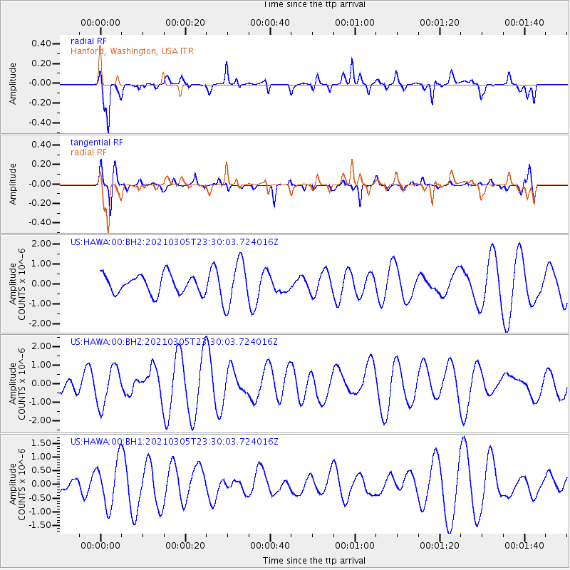
HAWA Hanford, Washington, USA - Earthquake Result Viewer
*The percent match for this event was below the threshold and hence no stack was calculated.
| Earthquake location: |
Kermadec Islands Region |
| Earthquake latitude/longitude: |
-28.9/-176.9 |
| Earthquake time(UTC): |
2021/03/05 (064) 23:17:30 GMT |
| Earthquake Depth: |
10 km |
| Earthquake Magnitude: |
5.6 Mww |
| Earthquake Catalog/Contributor: |
NEIC PDE/us |
|
| Network: |
US United States National Seismic Network |
| Station: |
HAWA Hanford, Washington, USA |
| Lat/Lon: |
46.39 N/119.53 W |
| Elevation: |
364 m |
|
| Distance: |
91.1 deg |
| Az: |
35.644 deg |
| Baz: |
227.583 deg |
| Ray Param: |
$rayparam |
*The percent match for this event was below the threshold and hence was not used in the summary stack. |
|
| Radial Match: |
67.77249 % |
| Radial Bump: |
400 |
| Transverse Match: |
41.6674 % |
| Transverse Bump: |
271 |
| SOD ConfigId: |
23341671 |
| Insert Time: |
2021-03-20 00:30:10.891 +0000 |
| GWidth: |
2.5 |
| Max Bumps: |
400 |
| Tol: |
0.001 |
|
Signal To Noise
| Channel | StoN | STA | LTA |
| US:HAWA:00:BHZ:20210305T23:30:03.724016Z | 1.0978919 | 1.0483459E-6 | 9.548717E-7 |
| US:HAWA:00:BH1:20210305T23:30:03.724016Z | 1.6144803 | 8.4911073E-7 | 5.259344E-7 |
| US:HAWA:00:BH2:20210305T23:30:03.724016Z | 2.4648216 | 1.119773E-6 | 4.543018E-7 |
| Arrivals |
| Ps | |
| PpPs | |
| PsPs/PpSs | |


