You are here: Home > Network List > IU - Global Seismograph Network (GSN - IRIS/USGS) Stations List
> Station XMAS Kiritimati Island, Republic of Kiribati > Earthquake Result Viewer
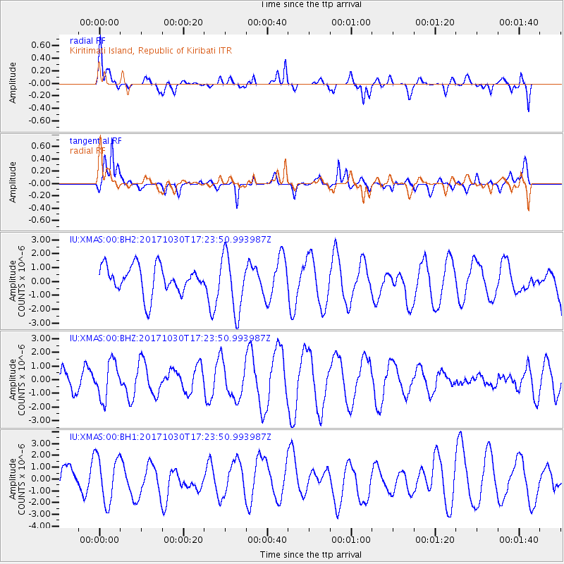
XMAS Kiritimati Island, Republic of Kiribati - Earthquake Result Viewer
*The percent match for this event was below the threshold and hence no stack was calculated.
| Earthquake location: |
Central Peru |
| Earthquake latitude/longitude: |
-10.7/-74.7 |
| Earthquake time(UTC): |
2017/10/30 (303) 17:12:06 GMT |
| Earthquake Depth: |
101 km |
| Earthquake Magnitude: |
5.7 mb |
| Earthquake Catalog/Contributor: |
NEIC PDE/us |
|
| Network: |
IU Global Seismograph Network (GSN - IRIS/USGS) |
| Station: |
XMAS Kiritimati Island, Republic of Kiribati |
| Lat/Lon: |
2.04 N/157.45 W |
| Elevation: |
20 m |
|
| Distance: |
83.3 deg |
| Az: |
273.358 deg |
| Baz: |
100.992 deg |
| Ray Param: |
$rayparam |
*The percent match for this event was below the threshold and hence was not used in the summary stack. |
|
| Radial Match: |
53.193077 % |
| Radial Bump: |
400 |
| Transverse Match: |
53.2094 % |
| Transverse Bump: |
400 |
| SOD ConfigId: |
2429771 |
| Insert Time: |
2017-11-13 17:14:00.549 +0000 |
| GWidth: |
2.5 |
| Max Bumps: |
400 |
| Tol: |
0.001 |
|
Signal To Noise
| Channel | StoN | STA | LTA |
| IU:XMAS:00:BHZ:20171030T17:23:50.993987Z | 1.7735367 | 1.3758391E-6 | 7.757602E-7 |
| IU:XMAS:00:BH1:20171030T17:23:50.993987Z | 1.6058795 | 1.9420158E-6 | 1.209316E-6 |
| IU:XMAS:00:BH2:20171030T17:23:50.993987Z | 2.073956 | 2.0957507E-6 | 1.0105088E-6 |
| Arrivals |
| Ps | |
| PpPs | |
| PsPs/PpSs | |


