You are here: Home > Network List > TX - Texas Seismological Network Stations List
> Station WTFS Witchita Falls > Earthquake Result Viewer
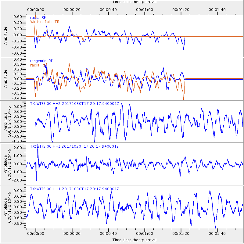
WTFS Witchita Falls - Earthquake Result Viewer
*The percent match for this event was below the threshold and hence no stack was calculated.
| Earthquake location: |
Central Peru |
| Earthquake latitude/longitude: |
-10.7/-74.7 |
| Earthquake time(UTC): |
2017/10/30 (303) 17:12:06 GMT |
| Earthquake Depth: |
101 km |
| Earthquake Magnitude: |
5.7 mb |
| Earthquake Catalog/Contributor: |
NEIC PDE/us |
|
| Network: |
TX Texas Seismological Network |
| Station: |
WTFS Witchita Falls |
| Lat/Lon: |
33.77 N/98.46 W |
| Elevation: |
277 m |
|
| Distance: |
49.7 deg |
| Az: |
333.878 deg |
| Baz: |
148.708 deg |
| Ray Param: |
$rayparam |
*The percent match for this event was below the threshold and hence was not used in the summary stack. |
|
| Radial Match: |
40.275562 % |
| Radial Bump: |
400 |
| Transverse Match: |
58.51173 % |
| Transverse Bump: |
397 |
| SOD ConfigId: |
2429771 |
| Insert Time: |
2017-11-13 17:15:23.583 +0000 |
| GWidth: |
2.5 |
| Max Bumps: |
400 |
| Tol: |
0.001 |
|
Signal To Noise
| Channel | StoN | STA | LTA |
| TX:WTFS:00:HHZ:20171030T17:20:17.940001Z | 2.5234454 | 7.4906416E-7 | 2.9684182E-7 |
| TX:WTFS:00:HH1:20171030T17:20:17.940001Z | 0.8654568 | 2.4903528E-7 | 2.877501E-7 |
| TX:WTFS:00:HH2:20171030T17:20:17.940001Z | 1.3711662 | 5.8309666E-7 | 4.2525602E-7 |
| Arrivals |
| Ps | |
| PpPs | |
| PsPs/PpSs | |


