You are here: Home > Network List > US - United States National Seismic Network Stations List
> Station ELK Elko, Nevada, USA > Earthquake Result Viewer
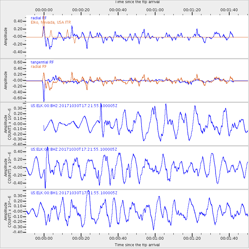
ELK Elko, Nevada, USA - Earthquake Result Viewer
*The percent match for this event was below the threshold and hence no stack was calculated.
| Earthquake location: |
Central Peru |
| Earthquake latitude/longitude: |
-10.7/-74.7 |
| Earthquake time(UTC): |
2017/10/30 (303) 17:12:06 GMT |
| Earthquake Depth: |
101 km |
| Earthquake Magnitude: |
5.7 mb |
| Earthquake Catalog/Contributor: |
NEIC PDE/us |
|
| Network: |
US United States National Seismic Network |
| Station: |
ELK Elko, Nevada, USA |
| Lat/Lon: |
40.74 N/115.24 W |
| Elevation: |
2210 m |
|
| Distance: |
63.4 deg |
| Az: |
326.485 deg |
| Baz: |
134.426 deg |
| Ray Param: |
$rayparam |
*The percent match for this event was below the threshold and hence was not used in the summary stack. |
|
| Radial Match: |
69.57432 % |
| Radial Bump: |
400 |
| Transverse Match: |
77.425964 % |
| Transverse Bump: |
400 |
| SOD ConfigId: |
2429771 |
| Insert Time: |
2017-11-13 17:15:51.915 +0000 |
| GWidth: |
2.5 |
| Max Bumps: |
400 |
| Tol: |
0.001 |
|
Signal To Noise
| Channel | StoN | STA | LTA |
| US:ELK:00:BHZ:20171030T17:21:55.100005Z | 2.2543736 | 2.597758E-7 | 1.1523191E-7 |
| US:ELK:00:BH1:20171030T17:21:55.100005Z | 1.3313994 | 1.1526484E-7 | 8.65742E-8 |
| US:ELK:00:BH2:20171030T17:21:55.100005Z | 2.1479545 | 1.5098374E-7 | 7.029187E-8 |
| Arrivals |
| Ps | |
| PpPs | |
| PsPs/PpSs | |


