You are here: Home > Network List > US - United States National Seismic Network Stations List
> Station HAWA Hanford, Washington, USA > Earthquake Result Viewer
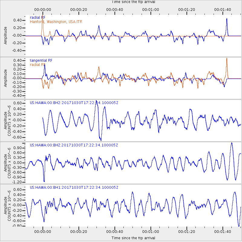
HAWA Hanford, Washington, USA - Earthquake Result Viewer
*The percent match for this event was below the threshold and hence no stack was calculated.
| Earthquake location: |
Central Peru |
| Earthquake latitude/longitude: |
-10.7/-74.7 |
| Earthquake time(UTC): |
2017/10/30 (303) 17:12:06 GMT |
| Earthquake Depth: |
101 km |
| Earthquake Magnitude: |
5.7 mb |
| Earthquake Catalog/Contributor: |
NEIC PDE/us |
|
| Network: |
US United States National Seismic Network |
| Station: |
HAWA Hanford, Washington, USA |
| Lat/Lon: |
46.39 N/119.53 W |
| Elevation: |
364 m |
|
| Distance: |
69.6 deg |
| Az: |
328.619 deg |
| Baz: |
132.323 deg |
| Ray Param: |
$rayparam |
*The percent match for this event was below the threshold and hence was not used in the summary stack. |
|
| Radial Match: |
64.592705 % |
| Radial Bump: |
400 |
| Transverse Match: |
61.413998 % |
| Transverse Bump: |
400 |
| SOD ConfigId: |
2429771 |
| Insert Time: |
2017-11-13 17:15:56.860 +0000 |
| GWidth: |
2.5 |
| Max Bumps: |
400 |
| Tol: |
0.001 |
|
Signal To Noise
| Channel | StoN | STA | LTA |
| US:HAWA:00:BHZ:20171030T17:22:34.100005Z | 1.1804527 | 4.5447618E-7 | 3.850016E-7 |
| US:HAWA:00:BH1:20171030T17:22:34.100005Z | 1.3692238 | 2.6924806E-7 | 1.9664284E-7 |
| US:HAWA:00:BH2:20171030T17:22:34.100005Z | 2.2601476 | 5.0505304E-7 | 2.2346022E-7 |
| Arrivals |
| Ps | |
| PpPs | |
| PsPs/PpSs | |


