You are here: Home > Network List > US - United States National Seismic Network Stations List
> Station LKWY Lake (Yellowstone--Lake), Wyoming, USA > Earthquake Result Viewer
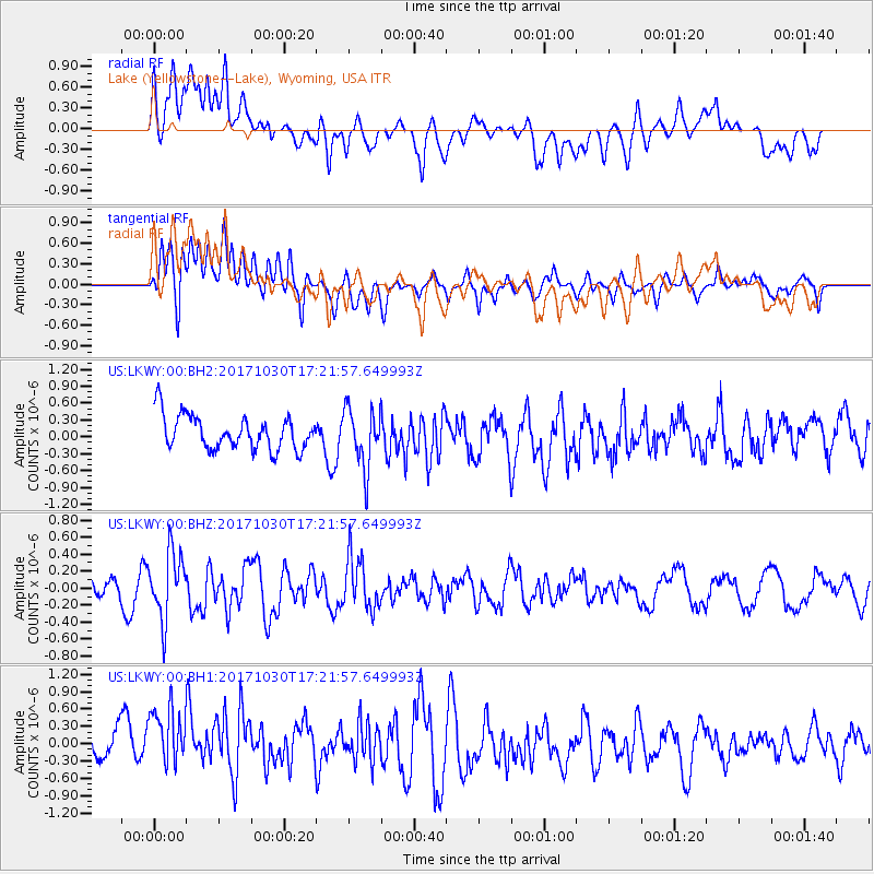
LKWY Lake (Yellowstone--Lake), Wyoming, USA - Earthquake Result Viewer
*The percent match for this event was below the threshold and hence no stack was calculated.
| Earthquake location: |
Central Peru |
| Earthquake latitude/longitude: |
-10.7/-74.7 |
| Earthquake time(UTC): |
2017/10/30 (303) 17:12:06 GMT |
| Earthquake Depth: |
101 km |
| Earthquake Magnitude: |
5.7 mb |
| Earthquake Catalog/Contributor: |
NEIC PDE/us |
|
| Network: |
US United States National Seismic Network |
| Station: |
LKWY Lake (Yellowstone--Lake), Wyoming, USA |
| Lat/Lon: |
44.57 N/110.40 W |
| Elevation: |
2424 m |
|
| Distance: |
63.8 deg |
| Az: |
332.301 deg |
| Baz: |
140.279 deg |
| Ray Param: |
$rayparam |
*The percent match for this event was below the threshold and hence was not used in the summary stack. |
|
| Radial Match: |
46.49636 % |
| Radial Bump: |
400 |
| Transverse Match: |
60.82105 % |
| Transverse Bump: |
400 |
| SOD ConfigId: |
2429771 |
| Insert Time: |
2017-11-13 17:16:07.108 +0000 |
| GWidth: |
2.5 |
| Max Bumps: |
400 |
| Tol: |
0.001 |
|
Signal To Noise
| Channel | StoN | STA | LTA |
| US:LKWY:00:BHZ:20171030T17:21:57.649993Z | 2.883922 | 3.929731E-7 | 1.3626342E-7 |
| US:LKWY:00:BH1:20171030T17:21:57.649993Z | 1.5135318 | 7.336813E-7 | 4.8474783E-7 |
| US:LKWY:00:BH2:20171030T17:21:57.649993Z | 1.7517141 | 5.297251E-7 | 3.0240386E-7 |
| Arrivals |
| Ps | |
| PpPs | |
| PsPs/PpSs | |


