You are here: Home > Network List > CI - Caltech Regional Seismic Network Stations List
> Station SMM Simmler, CA, USA > Earthquake Result Viewer
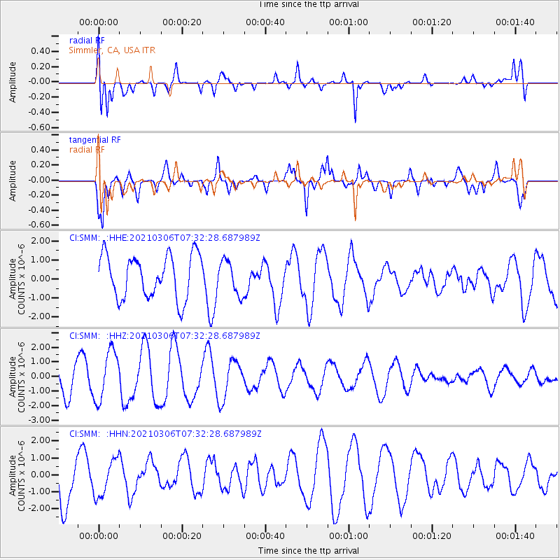
SMM Simmler, CA, USA - Earthquake Result Viewer
*The percent match for this event was below the threshold and hence no stack was calculated.
| Earthquake location: |
Kermadec Islands Region |
| Earthquake latitude/longitude: |
-28.6/-178.2 |
| Earthquake time(UTC): |
2021/03/06 (065) 07:20:29 GMT |
| Earthquake Depth: |
10 km |
| Earthquake Magnitude: |
5.5 mb |
| Earthquake Catalog/Contributor: |
NEIC PDE/us |
|
| Network: |
CI Caltech Regional Seismic Network |
| Station: |
SMM Simmler, CA, USA |
| Lat/Lon: |
35.31 N/120.00 W |
| Elevation: |
599 m |
|
| Distance: |
84.0 deg |
| Az: |
44.353 deg |
| Baz: |
228.748 deg |
| Ray Param: |
$rayparam |
*The percent match for this event was below the threshold and hence was not used in the summary stack. |
|
| Radial Match: |
71.751305 % |
| Radial Bump: |
400 |
| Transverse Match: |
51.318302 % |
| Transverse Bump: |
400 |
| SOD ConfigId: |
23341671 |
| Insert Time: |
2021-03-20 08:36:47.268 +0000 |
| GWidth: |
2.5 |
| Max Bumps: |
400 |
| Tol: |
0.001 |
|
Signal To Noise
| Channel | StoN | STA | LTA |
| CI:SMM: :HHZ:20210306T07:32:28.687989Z | 2.0773964 | 1.7239969E-6 | 8.298834E-7 |
| CI:SMM: :HHN:20210306T07:32:28.687989Z | 0.6299052 | 1.0842548E-6 | 1.7212984E-6 |
| CI:SMM: :HHE:20210306T07:32:28.687989Z | 0.79886025 | 9.0392837E-7 | 1.1315226E-6 |
| Arrivals |
| Ps | |
| PpPs | |
| PsPs/PpSs | |


